Mon River Trails – Day 1 (Sunday, June 27, 2021)

After over a year hiatus from biking the Hall of Fame trails, Joyce and I decided to resume our quest by riding the Mon River Trail network in West Virginia. Prior to our trip, Joyce brought their bicycles up to our house so that we could transport them to West Virginia. She and her husband, Ron, planned to fly to Washington, D.C. to visit their son, Henry, his wife and their granddaughter before renting a car and driving over to West Virginia to meet us.

View underneath Cooper’s Rock

Since I was born in West Virginia and enjoy visiting the state whenever possible, my husband, Ed, and I decided to take a few days to tour Pipestem State Park, the New River National Park, Summersville Lake, Blackwater Falls State Park, Dolly Sods, and Seneca Rocks prior to meeting Joyce and Ron at Cooper’s Rock State Forest, which is located about just east of Morgantown. Traveling during late June is a perfect time to see the WV state flower, the rhododendron, which was in full bloom at Cooper’s Rock SF. Joyce and Ron drove over from Washington, D.C. this morning, and we parked our travel trailer at the McCollum campground at Cooper’s Rock SF. We enjoyed a picnic lunch at our campsite and took a brief hike under Cooper’s Rock before driving to Morgantown.

Covered Shelter w/ Local Artwork

Leaving Cooper’s Rock, Joyce and Ron followed us to the Hazel Ruby McQuain Riverfront Park in downtown Morgantown where they parked their rental car and then rode with us to the northern terminus of the trail in Point Marion, PA. Ed dropped us off at the trailhead in Point Marion about 4:00 PM, and we biked south on the Sheepskin Rail-Trail (1.4 mile limestone trail from Point Marion to the WV state line) toward Morgantown. At the state line, we continued south onto the Mon River Trail and biked six miles along the Monongalia River to Star City where the trail became paved. The 5-mile portion of the trail from Star City through downtown Morgantown is know as the Caperton Rail-Trail.

View of Monongalia River from Trail

Our ride from Point Marion to Morgantown was mostly tree-canopied and offered frequent views of the Monongalia River on our right. The trail was well-maintained and hard-packed, which made it easier to bike. This portion of the trail was fairly flat, allowing us to maintain a steady pace. We passed a few benches and covered shelters, but we did not see any restroom facilities until we reached the restored train depot in Morgantown; however, the trail map indicates that there are restroom facilities at the Van Voorhis Rd trailhead (MM4).

Wamsley Cycles adjacent to Trail

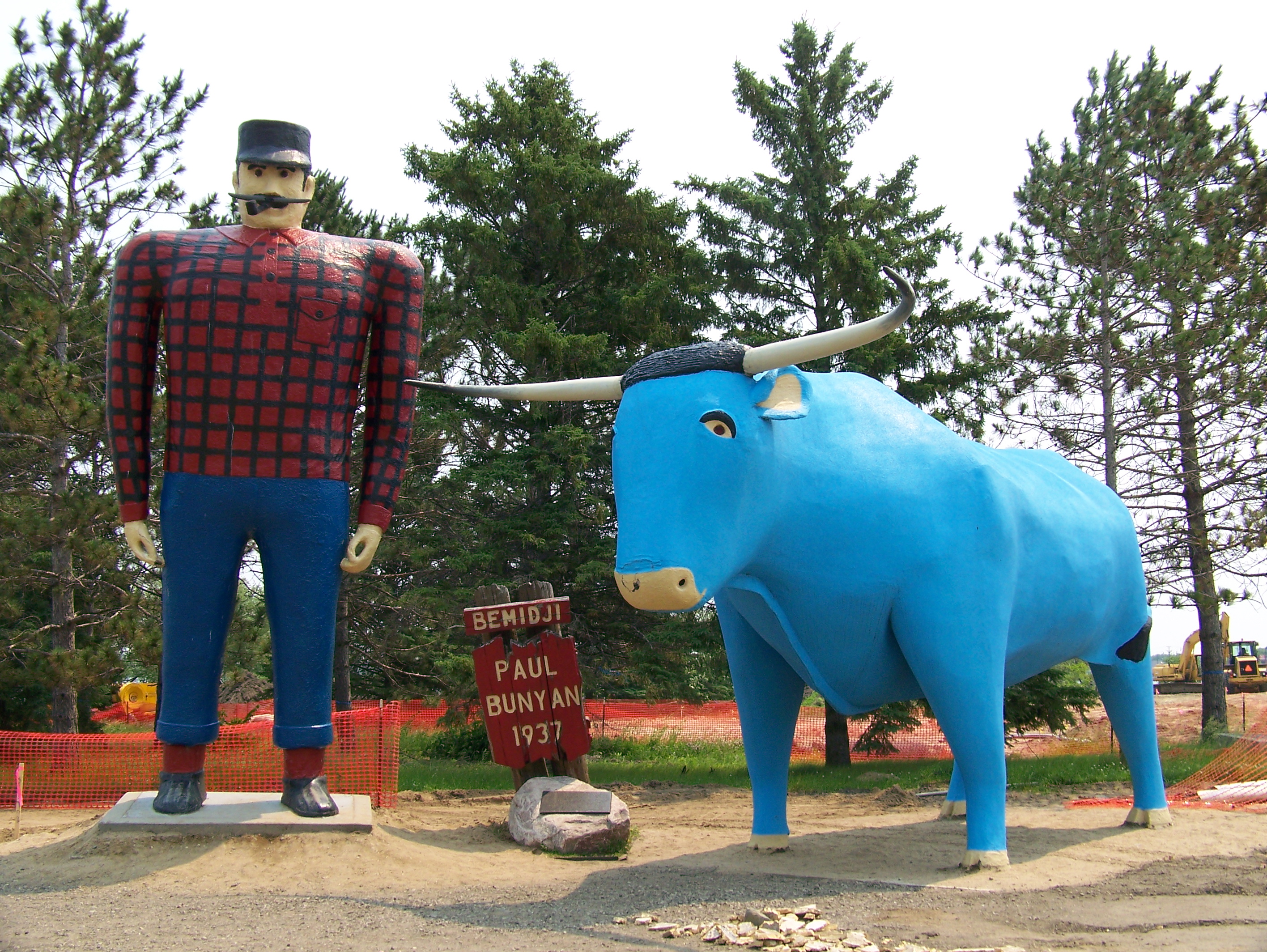
As we approached the outskirts of Morgantown, we passed a John F. Kennedy memorial (stopped for a photo op), the WVU Core Arboretum (wished that we would have had time to explore) and Wamsley Cycles (offers bike rentals and service adjacent to the Caperton Trail). My favorite view of the day was the WVU Mountaineer campus perched on the hillsides of Morgantown. The public university seems to dominate this college town, which is located in the northern part of the state, and its 20,000 students provide “life” to its local restaurants and businesses. We passed several college-age bikers on the trail. Although I did not attend West Virginia University, I’m a loyal Mountaineer football fan😊.


Amphitheater @ Hazel Ruby McQuain Park

When we reached the Hazel Ruby McQuain Riverfront Park, it was almost dusk, and the sun was beginning to set over the 2,000-seat amphitheater, which is located adjacent to the Caperton Trail along the banks of the Monongalia River. We decided to place one of the bikes in the Swofford’s rental car so that Joyce could drive about a mile south to the R2T parking lot where my husband had parked our travel trailer. Ron and I biked the remaining distance across the steel pedestrian bridge and past several riverfront eateries down to the R2T parking area where we met Ed and loaded the bikes onto the truck.

“Singing Tree of Diversity” on Caperton Trail

After our ride, we walked back up the Caperton Trail to the Mountaineer State Brewing Company where we ate dinner on the patio adjacent to the Monongalia River. Fortunately, the restaurant is pet-friendly, so we were able to bring Rudy, our 6-month-old King Charles Cavalier Spaniel to dinner with us. Ed and Ron tried their local craft beer, and we ordered dinner. I had the apple butter pulled chicken sandwich, and it was delicious.  After dinner, we walked back to our cars and drove to our respective lodgings for the night. Joyce and Ron are staying at the Holiday Inn Express in Weston, and we had a campsite reserved at the Stonewall Jackson Resort State Park. Although there are several closer accommodations to the Mon River Trail, we chose to camp at the Stonewall Resort, which is about an hour south of Morgantown.

Mon River Trails – Day 2 (Monday, June 28, 2021)

Martha & Joyce Exiting Tunnel

This morning, we picked up Joyce and Ron at their hotel in Weston and drove to Fairmont where we purchased sandwiches at The Joe before beginning our ride. Originally, we planned to buy pepperoni rolls in honor of the WV coal miners who often carried them in their lunch pales; however, the restaurant had gone out of business. Ed dropped us off at the southern terminus of the paved Marion County Trail (McTrail) where we packed our panniers for the day-long ride. We biked through a 1200-ft tunnel on the 2.5 mile ride to Prickett’s Fort. Although we had packed headlamps to ride through the tunnel, we didn’t need them because it was well lit. The temperature in the tunnel was at least 10 degrees cooler inside. Joyce and I enjoyed the ride through the tunnel so much that we decided to ride through it again.

Prickett’s Fort State Park

It was a little after 10 AM when we reached Prickett’s Fort State Park. We parked our bikes and took a brief walking tour of the fort before resuming our ride. The park includes an 18th century recreation of Prickett’s Fort which provided refuge to colonial Virginians from Native Indians. At Prickett’s Fort, the McTrail connects to the southern portion of the Mon River Trail. We biked 19 miles north on the limestone Mon River Trail back to Morgantown. The southern section of the Mon River Trail is slightly downhill and very scenic, offering frequent views of the Monongalia River on our left. We passed numerous benches and a few covered pavilions but no restroom facilities.  This portion of the trail is very remote and there are only a few access points.

Trickle of Water @ Little Falls

We had planned to eat our picnic lunch at the foot of Little Falls, but there was barely any water flowing down the overhanging rocks. We were disappointed that the falls did not match our expectations. Prior to the trip, I saw a picture of the waterfall and thought it would be a perfect spot for our lunch; however, the photo must have been taken after a rainstorm or melting snow. Even though West Virginia is not in a drought, we would have biked right past the falls had Joyce not noticed the trickle of water flowing down from the rocks above. Joyce and Ron decided to eat at a nearby bench overlooking the river, but I climbed a few steps off the trail down to the base of the trickling waterfall and enjoyed the cooler temperatures while I ate my sandwich. After lunch, we approached a covered pavilion less than a mile north of Little Falls, which probably would have been a better spot to eat.

Monongalia River Lock near Morgantown

On our ride north to Morgantown, we passed at least two river locks. Monongalia is one of only a few rivers in the United States that actually flows south to north. We stopped to observe the locks and continued on our ride. We arrived in Morgantown about 45 minutes earlier than expected so we decided to enjoy a rootbeer float at the Mountaineer State Brewing Company while we waited for my husband to pick us up at the Mon River Trail parking lot. From Morgantown, we drove east along Deckers Creek toward Reedsville. Although we did not have time to bike the entire length of the Deckers Creek Trail, which is also part of the Mon River network, we decided to bike a 7-mile scenic portion from Masontown to Mellons Chapel.

Martha on Deckers Creek

The Deckers Creek Trail begins at the Hazel Ruby McQuain Riverfront Park in Morgantown and travels 18 miles southeast to Reedsville. We chose to bike northwest from Masontown to Mellons Chapel to take advantage of the 2% downhill grade. This portion of the trail paralleled Deckers Creek and was extremely scenic. We spotted a couple of riders who had abandoned their bicycles beside the trail to take an afternoon swim in the creek below. The shoals and small waterfalls along the creek offered a spectacular backdrop for this portion of the trail. Succumbing to temptation, I decided to park my bike and scramble down to the water where I removed my shoes and dipped my feet into the cool, rushing water. Joyce and Ron followed me down to the water’s edge, and we took a moment to soak in this beautiful spot. Although I fell a few times on the slippery rocks, I do not regret my decision to “get my feet wet.”

Returning to the trail, we biked a couple more miles to the parking lot at Mellon’s Chapel where Ed was waiting for us in the parking lot. Joyce and Ron rode with us, and we dropped them off at their hotel on our way back to our campsite. Later that evening, Joyce and Ron joined us at our campsite for dinner (enchiladas, salad, and garlic bread). After dinner, Joyce and I kayaked in Stonewall Lake. This was the perfect ending to resuming our bike rides on the Hall of Fame Trails. I can’t wait for the opportunity to vote for the 2021 inductee to the Hall of Fame trails, which will determine our next trip…

Wabash Trace Nature Trail, southwest Iowa

Even though Martha had already ridden a portion of this trail last May when she did the Mickelson Trail in South Dakota, she had agreed to do this whole trail with me this summer, and Ed had consented to driving us to the location to give us more flexibility in making the trip. Therefore, this was a packed—very packed to be exact—four day driving and biking trip to the cornfields of Iowa and back to Atlanta. What packed it was not so much the length of the trail but the driving time to and from the trail, and the two side trips we took near Des Moines that added interesting “probably-won’t-have-this-opportunity-again” novelty to the excursion. Instead of blogging this as four separate days, though, we decided to combine all events into one posting from each of us, which means I’ve decided to categorize the information into topics rather than chronologically. (I don’t know how Martha is doing hers.)

Loes Hills

Loess Hills

I’ll start with the bike experience, since that was the purpose of the trip and my main reason for doing these blog entries. At 63 miles, the Wabash Trace Nature Trail extends from a park on the outskirts of Council Bluffs, Iowa, to a tiny little town on the Missouri border, Blanchard, Iowa. It is definitely a rural area, filled with soybean and corn fields, a few very small towns, and rolling hills (the brochure says these are actually topological terrains called Loess, meaning “loose soil” from wind and erosion following the glaciers). The trail view was canopied by walnut and other hardwood trees and thus mostly shady for almost all the way, which was nice, but which also gave us practically the same scenery to look at for several hours. It was broken by expansive views of the countryside—acres and acres of thickly planted, healthy looking, corn and soybean. Actually, it was rather pretty seeing all this agriculture beyond our relatively narrow trail. We saw few wild flowers (maybe two or three quick patches) and some chipmunks, birds, butterflies, and grasshoppers.

Malvern Trailhead

Malvern Trailhead

Around Council Bluffs we passed several other trail users, but on the second day’s ride only nine other people total. Probably the most interesting part of the ride was crossing many trestles that carried us over scenic streams, narrow irrigation canals, and several relatively wide rivers (the names of which I will have to look up on the map as there were no signs indicating their names). And speaking of signs and other amenities along the trail, for the ten or so miles south of Council Bluffs, we had markers indicating even quarter mile lengths, but after that, the only mile markers were old white ones probably from the railroad days because they did mark the miles but we could never figure out the beginning or ending locations of the numbers. After the town of Malvern, about twenty miles south of Council Bluffs, we saw maybe two or three benches and NO public toilet facilities. (I guess if the little building in Shenandoah—which, by the way, had no sign naming it as an old Shenandoah railroad building—had been opened—it was Sunday—they probably had restrooms), but even at the southern end of the trail, there was nothing. I will compliment two resting spots on this southern end that appeared to have been donated by private families: one was a covered swing big enough for two or three people, and one was an unusual wooden bench for two people that looked more like a chase lounge with a back and knee prop, looking sort of like an S without the top curve. As I pedaled off after stopping to try it out, I wished that I had taken a picture of it, but by then it was too much hassle to turn around and go back for the photograph. A person named Don had inscribed on it “Sit down and rest a bit; you’re making me nervous” (or something like that). I thought it was cute, and it definitely was comfortable.

Wildflowers & Cornfields

Wildflowers & Cornfields

We divided our ride into two stretches—Saturday late afternoon we did 22 miles from Council Bluffs to the town of Malvern (not a bad size little town) for a two and one/half hour ride, and Sunday morning we did the other 41 miles from Malvern to Blanchard, for a five hour ride. It didn’t take us the whole five hours to bike, of course, because we had some short picture and refreshment breaks, but I will say that our average speed was definitely slowed down by the upkeep of the trail. Most of it was hard-packed crushed limestone and dirt combination, with some places where the newly-added crushed rocks were not as packed as we would have preferred, and around a couple of the small towns there was some paved stretches.   Seems to me it definitely is not a trail for road bikes’ skinny tires. Concerning the difficulty/ease of the ride, the trail had a lot of ups and downs that slowed us down on the ups, not steep elevation gains but long enough of gradual inclines to where we could feel in our legs and speed that we were definitely going uphill several times. It also crossed numerous gravel county roads, at which we had to pretty much stop in order to see that the crossing was clear.

Shenandoah Trailhead

Shenandoah Trailhead

The upkeep of the trail from Shenandoah to Blanchard had much to be desired on the day we rode it, especially the last ten or fifteen miles. Tree limbs and twigs and some loose rocks were lying scattered over much of the trail, weeds were growing in the trail, overhanging limbs with leaves had to be pushed out of our way as we rode past them, and the trail had some holes and ruts that also had to be dodged as we pedaled along. This condition prompted a conversation about how if a trail is going to be named a “Hall of Fame Rail to Trail,” then the upkeep should be maintained to a higher quality or dropped from the list. To emphasize our concern, let me describe the end/beginning of the trail in Blanchard: it merely stops. Just stops. Grass/weeds are growing to the sides and at the end as it heads into/out of the woods, and we could see a street with a small post office and a couple other old buildings about 50 yards to our left. There was NO sign indicating it was even the Wabash Trace Natural Trail. Actually, it was quite disappointing. If we had been beginning the ride there, to ride south to north, it would have been quite difficult to know where to start. In our case, we were finishing, so we walked our bikes across the weeds to the main street, where Ed was waiting with the truck. I didn’t even see a sign indicating that this was Blanchard, except for the post office.

Holliwell Bridge

Holliwell Bridge

So we left Blanchard and began heading northeast on the state roads back toward Des Moines where Martha wanted to see the two covered bridges that were used in filming Bridges of Madison County, one of her all-time favorite movies with young Clint Eastwood and Meryl Streep. Since I had not seen the movie, it was just entertainment factor and because Martha wanted so much to see them that I voted for this two hour deviation on our trip back to St. Louis. Besides, this might be the only time in my life that I would ever drive these gravel roads to see these covered bridges. So we saw the Roseman Covered Bridge and the Holliwell Covered Bridge, both built in the early 1880s. I must add they were historically interesting, I’m sure more meaningful had I seen the movie.

John Wayne's Birthplace

John Wayne’s Birthplace

Between the bridges we drove through the town of Winterset, Iowa, and drove past the birthplace home of the western movie star, John Wayne (although that wasn’t his birth name). It is a very small, white, corner house that might have been interesting to go inside, but time was at a premium. That was around 6 pm and the road construction detour added an additional hour delay, so we didn’t reach our motel until around midnight. It was a long drive to end a long day that started at 7:30 am heading to the bike trail.

Trump with Kids

Trump with Kids

My reference above of “back to Des Moines” was because after we had left Columbia, Missouri, (our first night stop) on Saturday morning we drove north and a little bit east for four hours to get to the Iowa State Fair, where Martha had meticulously researched the location of Donald Trump’s (Republican primary presidential candidate) helicopter landing and press conference that actually wasn’t publicized to the public, so we would be part of a small crowd of people and could probably see and hear Trump up close. The site was actually not in the fairgrounds (that would have been very crowded, as it is a big deal in Iowa) but at a girls’ softball field about a mile from the Fair. Martha’s lengthy sleuthing paid off, and we indeed arrived at the right spot about an hour before Trump made his appearance in his TRUMP helicopter. Because we were there so early, we received “Trump Make America Great” t-shirts and mingled with some of the reporters as we awaited his arrival. (We heard a campaign worker tell a reporter that this was all about giving kids rides on his helicopter, not about publicity, but his arrival was QUITE ostentatious.) I had quickly contacted Ron, Henry, and Tommy to watch for me on TV at 1: 15, and they were all watching the TV news, but the secret service had moved us all behind the fence so that we couldn’t stand behind Trump during the press conference, and then when he moved to the helicopter with all the kids he was taking up, I didn’t move fast enough to get into that crowd and be seen through the TV cameras. Ron said he was pretty sure he saw Ed standing by a reporter. Oh well, it was entertaining and, as Tommy said, maybe another time I’ll be on the news. Not that I’m a fan of Trump, or even supporting him in his candidacy, but it was a different and not-so-common experience. And as Martha and I say, it’s good to be flexible on these bike trips, as the side-trips are part of the experience.

And now we’re on our eight-hour drive back to Atlanta, barring any more road detours or accident traffic jams.  I’ll have some interesting events to recount in Johnny’s and my Deutschkurs as we share in German about unsere Wochende.

Wabash Trace Trail – Take Two

In May 2013, Ed (my husband) and I biked a brief portion (14 miles) of the Wabash Trace on our way to South Dakota. Since Joyce hadn’t ridden the Wabash Trace, I agreed to ride the whole trail with her. Ed offered to drive us to Iowa and to provide shuttle service for us 🙂 . We left Atlanta on Friday morning at 9 AM and drove 10 hrs to Columbia, Missouri to spend the night. We stayed in a brand new Candlewood Suites Hotel and ate dinner at a Mexican restaurant close to the hotel.

Trump Exiting Helicopter

Trump Exiting Helicopter

While driving to Iowa, Ed joked about going to the Iowa State Fair to see the presidential candidates while Joyce and I biked the Wabash Trace. After looking at the maps and candidate schedule, we decided that ALL of us should take the detour to the Iowa State Fair in Des Moines on our way from Columbia to Council Bluffs. After two hours of searching on Twitter, etc., I discovered that Donald Trump planned to land in one of his helicopters at a baseball field near the fairgrounds. According to the press release, Trump planned to hold a brief press conference and to give some lucky kids rides in his helicopter prior to going to the fair. So, we decided to get up early and drive four hours to Des Moines in hopes of getting to see his dramatic entrance to the fair! When we arrived at the baseball park, there were less than 50 people waiting to see Trump. The media release that I found online specifically stated that the landing site was not to be shared with the general public, which explained the small crowd. We asked the policeman stationed at the park’s entrance if we were allowed to stay for the press conference, and he said “Yes.”

Trump Speaking to Press

Trump Speaking to Press

We parked our truck and walked over to the ball park where we staked out a spot along the outfield fence directly in front of the microphone where Trump would address the press. The crowd grew to about 200, but most of them were press or Trump Team staff members and their children. There were 2-3 secret service agents and two local policemen. After a short wait, Trump’s helicopter came into sight and circled the adjacent fairgrounds a couple of times before landing on the pavement in front of us. After exiting the chopper, Trump walked to the microphone and answered questions for about 20 minutes. He welcomed the children and asked them to come stand with him. After his speech, he took a chopper ride with some of the children and newscaster, Martha Radditz from ABC. The helicopter pilot continued to give rides to groups of children while Trump and his staff rode by golf cart to the fairgrounds. We followed in our truck and three cameramen, including one from CNN, asked to hitch a ride with us. When we arrived at the ticket gates, Trump had already entered the midway and was surrounded by hundreds of Iowans. We were thankful that we got to see and hear him without the crushing crowds 🙂 .

Council Bluffs Trailhead

Council Bluffs Trailhead

After our Iowa State Fair drive-by, we drove two hours west to the northern terminus of the Wabash Trace in Council Bluffs. We unloaded our bikes, geared up, and started pedaling about 4 PM. Ed went to check into our hotel, and he later met us at 7 PM in Malvern, 22 miles south.

Tree Canopied Trail

Tree Canopied Trail

Despite the summer heat, Joyce and I enjoyed the ride; there was a nice breeze and the trail was predominantly tree-canopied. I was relieved that the crushed sandstone trail was hard-packed with no visible ruts or debris. Our 2 ½ hour ride went by quickly as we pedaled past beautiful Iowa cornfields. We arrived in Malvern 30 minutes earlier than expected so we parked our bikes, purchased a cold drink at C&M’s Café, and waited for Ed at a wrought iron table on Main Street. Other bikers who purchased ice cream cones at the café told us about their 3-day biking and camping adventure on the trail.

Quaker Steaks & Lube

Quaker Steaks & Lube

Ed transported us back to the Holiday Inn Express in Council Bluffs. After a quick shower, Ed and I went to eat wings at Quaker Steak & Lube, a unique car-themed restaurant, while Joyce chose to eat free Saturday night pancakes at the hotel. We got a good night’s sleep and ate a scrumptious breakfast, including decadent cinnamon rolls, before leaving the hotel. Ed dropped us off in Malvern about 9 AM, and we pedaled 41 miles south to Blanchard, which is located on the Iowa-Missouri state line.

Bridge on Wabash Trace

Bridge on Wabash Trace

I enjoyed the first 20 miles of our ride from Malvern to Shenandoah. Although the trail climbed and descended numerous hills, the climbs were not steep or long. Today, we saw more soybean crops, and there were numerous wooden bridges spanning small rivers and creeks. Most of the bridges were short; however, there were a few longer ones with iron trusses. We noticed numerous large red-tail squirrels and countless butterflies of all colors. Until we reached Shenandoah, the trail was mostly tree-canopied. We spotted several large walnuts on the trail and noticed more wild flowers today than yesterday.

Wildflowers & Corn Fields

Wildflowers & Corn Fields

We stopped in Shenandoah to eat a snack and to call Ed to let him know that we were running about 30 minutes behind our anticipated arrival time in Blanchard due to the hilly terrain. Leaving Shenandoah we had a difficult time finding the trail. After a brief period of feeling lost, we were able to spot the green bike route signs directing us back to the trail.

Shenandoah Station

Shenandoah Station

Below Shenandoah, the trail was much more exposed to the sun. In addition, this portion of the trail was not well maintained. Encountering tree limbs every few feet made it imperative to keep our eyes fixed on the trail to avoid the frequent obstacles. There were also several sections of loose gravel, which made traction a little treacherous. Since there were very few bikers on the trail, we encountered numerous cob webs spanning across the path. Needless to say, I did not enjoy this portion of the trail as much the northern part. The trail conditions and afternoon heat made the last 10 miles more challenging. At one point, I stopped and poured my water bottle over my head to cool off 🙂 . When we arrived in Blanchard, Ed was waiting for us about ¼ mile from the abrupt, non-eventful trail end. As I pushed my bike through the thick grass leading over to the street where Ed was parked, I was extremely thankful that we completed the 63-mile trail without getting a flat tire!

Roseman Bridge

Roseman Bridge

After loading our bikes, I persuaded Ed and Joyce to drive two hours out of our way to Madison County, home of the famous covered bridges where the movie Bridges of Madison County was filmed. En route to the small town of Winterset, the home place of John Wayne, we ate lunch and a hot fudge sundae at McDonald’s. About two hours later, we arrived at the dirt road leading to the 107-foot Roseman Bridge, which was built in 1883. I relived the scenes from the movie, snapped a few pictures, and browsed the gift shop located adjacent to the bridge. We decided to drive through Winterset to see John Wayne’s birthplace on our way to the Holliwell Bridge located about 3 ½ miles southeast of town. The 122-foot Holliwell Bridge was built in 1880 and was also featured in the film. Despite the extra driving, I am extremely thankful that my husband agreed to this side trip; we may never have this opportunity again!

We plan to drive to St. Louis tonight (ETA midnight) and back home to Atlanta tomorrow. Originally, when we planned this quick trip to Iowa, I did not anticipate any opportunity for sightseeing. However, we not only saw a press conference with the Republican front-runner for President but we also visited the beautiful covered bridges of one of my all-time favorite movies. Biking the Hall of Fame trails started out as a dream, but Joyce and I made it a reality! If you have a dream, don’t allow the mundane obligations of life to silence your desires, confining your dreams in a box…live each day to its fullest!

“…realities that kept the music silent, the dreams in a box.”
Robert James Waller, The Bridges of Madison County


Upper Great Lakes – Day 6

Cabin @ Ruttger's

Cabin @ Ruttger’s

The bright morning sun shining through the glass doors of the cabin woke us up early. We packed our gear and took a walk around Ruttger’s Resort before breakfast. Joyce had made arrangements with Enterprise Car Rental at the Bemidji Airport to send a driver to pick us up around 8:30 AM. Krista, the Enterprise driver and native Minnesotan, told us that she is a photographer and avid Loon follower. In fact, she planned to go to a nearby lake that evening to listen to their haunting, yet musical birdcalls.

Headwaters of the Mississippi

Headwaters of the Mississippi

After renting the car, we returned to Ruttger’s, loaded our bikes, and drove to Itasca State Park, the headwaters of the Mississippi. Joyce took off her socks and shoes and waded through the water while I captured this moment on film.  It’s hard to believe that the Mississippi River runs 2552 miles from spring-fed Itasca Lake in Minnesota to the Gulf of Mexico. Wanting to learn more but running short on time, we exited the state park and resumed our route to the Fargo Airport.

Great Northern Bicycle Company

Great Northern Bicycle Co.

Prior to our trip, we made arrangements with Great Northern Bicycle Company to ship our bikes home. We were impressed by the professionalism and efficiency of this well-established bike shop located in the restored train depot in downtown Fargo. Within minutes, they checked in our bikes and helped us complete the paperwork so that we could get to the airport to catch our flight.

The Fargo airport was smaller than we anticipated. We returned our rental car, purchased sandwiches to eat on our flight, and went through security (my selfie stick aroused suspicion so my bag was searched) to our gate. After a short connection in Chicago, we returned to Atlanta. I was glad to be home to my husband and family, and I felt a rewarding sense of satisfaction for reaching my goal!


Day 5: Paul Bunyan State Trail, day three

It was another good day of perfect weather, a ride with no problems, and good scenery, but sadly our last ride of this trip. After a breakfast at Walker Bay Coffee shop near the lodge, where we talked with bikers Jeff and Barb Hansen of Fargo, ND, who were also staying at the Chase lodging and who also told us to tell the Great Northern Bike workers that “Jeff said you would take good care of our bikes” (he had worked there for a while)” we were ready at 8:45 a.m. to leave the town of Walker and head back to the Heartland State Trail, which would take us back onto the Paul Bunyan State Trail on our way to Bemidji.

Field of Yellow Flowers

Field of Yellow Flowers

The scenery on this ride was much more like I expected the entire trail to be—some isolated hardwood and pine forests, some crop farmland, some pasture farmland, and lakes. Although this direction was slightly uphill almost the whole way, the environment helped us forget about our slower speed. We were much more isolated, crossing a few major public roads, but the roads that paralleled the trail were for the most part private or rarely traveled dirt public roads.   We had some “loner” riding sections for individual reflections and some “together” riding sections where we talked about the upcoming CSRA (retiree group) planning meeting. We saw a deer on the trail, a lone duck on the trail, bunny rabbits, a variety of birds, and colorful wildflowers.

Joyce Poses as the Blue Ox

Joyce Posing as Paul Bunyan

After 32 miles we reached the town of Bemidji, which I had heard a lot about when I was in graduate school at the University of Minnesota back in 1969. It’s nothing spectacular, but it seems like a good Minnesota town, and it’s right on Lake Bemidji. It advertises itself as the first town on the Mississippi River because the headwaters of that river are not far from here, and the river flows into Bemidji Lake on the south side of the lake and out of it on the west side. Therefore, we crossed the Mississippi River twice today. Dean Beattie in the Tourist Information Center willingly answered all our questions about the original railroad line, the river, the town, and the newly completed trail all the way around the lake. It was here that we took our pictures with another Paul Bunyan statue and with Babe, the Blue Ox. After lunch at Subway, we rode another 11 miles north to the “actual” end of the trail and then into the “other” end of the trail in Lake Bemidji State Park. The “real” ending/beginning of the Paul Bunyan is quite uneventful and drab—there’s a sign at least—where the dirt Blue Ox Trail ends and the paved Paul Bunyan Trail begins.

Trail End @ Bemidji SP

Trail End @ Bemidji SP

The bike ride through the state park into the advertised end of the trail was gorgeous, but even there we saw no designed “Trail Ends” marker. I guess to most people finishing the trail is not the big deal it is to us. A friendly guy took our picture in one spot, and we used Martha’s selfie stick to take another picture of us finishing this last trail in another spot in the park. We then rode out of the state park and two miles over to Ruttger’s Lodge on Lake Bemidji, giving us a total of 45 miles for today. A good distance, and it makes our total on this trip to be 183 (34, 40, 64, 45) miles over four days. Not bad for my age.

Canoe Ride on Lake Bemidji

Canoeing on Lake Bemidji

Our cabin at Ruttger’s is rustic and nice. It sits probably ten feet from the shoreline and has a big screened-in porch in the front. After checking in, Martha and I went canoeing out on the lake and saw two loons (the state bird) quite close up. It’s quite an interesting, good looking bird. Martha got a good picture of them. They were something she really wanted to see, so I’m glad we were able to get that close to them. Now that we’ve eaten dinner and have almost finished writing today’s entry in this blog, it’s time to relax out on our porch and watch the sun go down on a good final Hall of Fame Trail day.

Joyce Wading in the Mississippi

Joyce Wading in the Mississippi

Tomorrow morning Enterprise Car Rental said they’d pick us up to get the rental car in Bemidji. Then we pack up and head to Fargo. On the way, we’re stopping at Lake Itasca, where the Mississippi River begins flowing, actually north, eventually into Lake Bemidji and then it takes a western and southern turn down through Minneapolis/St. Paul and on down to the Gulf. The story of shipping the bikes home at the bike shop in Fargo is the end result of our finding out just a few days before we took off that the Amtrak Station in Fargo is only open from midnight to 7 a.m., and we won’t be there then for the original plan. The Greyhound station in Fargo would have shipped the bikes but to Atlanta Greyound, but they didn’t sell bike boxes. So we even considered FedExing the used bike box from Milwaukee on up to Ruttgers, where we could FedEx the bike home to Atlanta, but we didn’t have time in the Milwaukee Amtrak station to walk the boxes over to the FedEx in Milwaukee. Finally, Martha was able to get hold of the Great Northern Bike Shop in Fargo. We’re keeping our fingers crossed that they won’t have to take the bike apart so much for shipping that we have to pay someone to reassemble it for us when we get it to Atlanta. We’ll see, but I’m sure it will all work out. It always does.

Upper Great Lakes – Day 5

Walker Bay Coffee Company

Walker Bay Coffee Company

The beds at The Chase on the Lake were extremely comfortable, and I got a good night’s sleep. Since we did not close the curtains on our lakeside room, I awoke at 5:00 AM when the first sunlight stretched across the water – what a fabulous way to wake up! I worked on our blog until the alarm went off at 7 AM. We decided to eat breakfast at Walker Bay Coffee Company, which is located about two blocks from the hotel. I had a delicious breakfast sandwich and purchased a decadent sweet roll for later on the trail 🙂 .

Regularly-spaced Bird Houses along Trail

Regularly-spaced Bird Houses along Trail

We left the hotel about 9 AM and pedaled west a couple of miles to the junction of the Heartland & Paul Bunyan trails where we turned north. The first 12 miles passed by quickly as Joyce and I discussed our upcoming planning meeting for the Clayton State Retirees Association. We passed through Benedict without even noticing and stopped in Laporte for a quick bathroom break (porta potty style). After five more miles, we reached Guthrie where we ate our previously purchased cinnamon roll. It was SO scrumptious that I wished we had purchased one apiece! I noticed another senior-aged couple in the parking lot,  and I asked them for directions to the Paul Bunyan Trail Office in Bemidji. They have lived nearby for several years but had never heard of a trail office. We shared stories about the trails that we both had ridden when I suddenly realized that I was getting several bug bites on my legs. I sprayed my arms and legs with Skin-so-Soft Bug Repellant by Avon, and we resumed our bike ride.

During the next 11 miles to Bemidji, we encountered a brief rain shower. A biker traveling in the opposite direction warned us about the approaching rain so Joyce and I put on our waterproof jackets. Although we felt a few rain drops and the trail ahead was wet, we were fortunate enough to miss the rain. As the skies became brighter, we removed our steamy jackets at the next town.

Northern Pines

Northern Pines

Today’s ride seemed more like the “Northwoods.” The trail was more remote, and there were beautiful stretches of northern pines. We approached a large deer grazing along the edge of the trail, and he stared at us as if he did not usually see people. Speaking of people, we only encountered a handful of bikers today – another reason that the trail seemed more isolated.

Paul Bunyan & Babe, the Blue Ox

Paul Bunyan &
Babe, the Blue Ox

We arrived in Bemidji about 1:00 PM and took an extension trail along the lake to the Visitor Center where the original Paul Bunyan & Babe the Blue Ox statues are located. The agent at the visitor center was extremely helpful, offering us maps of Bemidji with instructions for locating Ruttger’s Resort, our accommodations for the night.

With our bikes chained to a post at the visitor center, we walked across the busy highway to Subway where we purchased lunch. Since it was sunny and hot outside, we chose to eat in the cool air condition before proceeding east around Lake Bemidji. We somehow missed the trail on the other side of town, but we were fortunate to find a teenager on his bike who offered to let us follow him back over to the trail.

Mississippi River Flowing North from Lake Bemidji

The trail followed the rim of the lake and provided brief glimpses of the water through the trees. In a couple of miles, we crossed over the Mississippi River as it flows east out of Lake Bemidji. Dean at the Bemidji Visitor Center explained that the path of the Mississippi River actually forms a question mark as it flows north into Lake Bemidji before curving and heading south. Tomorrow, on our way to the airport in Fargo, we plan to drive over to the headwaters of the Mississippi at Lake Itasca about 30 miles southwest of Bemidji.

End of Paul Bunyan Trail

End of Paul Bunyan Trail

As we continued north, we passed a few rollerbladers who were gliding along about 11 mph! When we reached the intersection leading west to Bemidji State Park, we decided to continue north for a couple more miles to the official end of the Paul Bunyan Trail. The trail ended abruptly at the intersection of a highway, and we noticed that the unpaved Blue Ox Trail to Canada started across the road. We chatted with a couple staying at the state park and then turned around and headed south to the cut-off trail leading to Bemidji State Park. The short, somewhat hilly ride passed through a dense hardwood forest leading to the park’s picnic area and campground. I felt this trailhead marked a more significant ending for the trail. We took some celebratory photos and ate a cookie beside the lake 🙂 .

Ruttger's

Ruttger’s Resort

Continuing out of the state park, the trail followed the road for about 2-3 miles before we turned left into Ruttger’s. I chose this resort as our final destination several months ago. It is a family-owned, historic resort which has served northern Minnesota for 100 years! The lakeside resort is comprised of two lodges and numerous cabins. We were fortunate enough to upgrade to a cabin located 20 feet from the lake’s shore! Our cabin is rustic, but it reminds me of the camps I stayed at as a teenager and later as a youth advisor.

Loons on Lake Bemidji

Loons on Lake Bemidji

Joyce and I parked our bikes in the screen porch of the cabin, put on our bathing suits, and walked down to the boathouse where we rented a canoe (all of the kayaks were already rented). We paddled a couple of miles around the northern fringe of the lake and spotted a loon, the Minnesota state bird. On our return trip, we noticed that there were now two loons feeding in the same area. We quietly paddled toward the birds, and I was able to take a few close-up pictures 🙂

Inflatable Mountain

Inflatable Mountain

We returned the canoe and sipped a free glass of wine (Joyce had water) and ate some crackers & cheese on our way to the indoor pool. Joyce swam laps while I soaked in the hot tub. After changing our clothes, we walked over to the hotel restaurant where we were fortunate to find a table on the outside terrace overlooking the lake. We split a pizza and enjoyed watching a family climb the 30-foot inflatable mountain and then dive into the lake.

Today was a very special day! We finished the Paul Bunyan Trail, marking my last Hall of Fame Trail! I chose to celebrate by staying at a historic resort which was once frequented by millionaires and important dignitaries, including Mrs. Woodrow Wilson. Although biking the Hall of Fame Trails does not require fame or fortune, I feel that what we have accomplished is significant. As darkness covered the lake, I sat on the front porch of the cabin listening for the loon’s choir-like song, and I decided that no other praise for our achievement would be quite as special!


Day 4: Paul Bunyan Trail, day two

After breakfast and a game of ping pong at the lodge from last night, we stopped at a nearby convenience store to buy our picnic sandwiches, and we were on our way at 8:45 a.m.

Warning Sign through Chippewa Forest

Warning Sign through Chippewa Forest

It was another great day! We actually rode 64 miles, the farthest I can remember us ever riding in one day. It would have been 44, but we added 20 miles to the trip by diverting to the Shin-go-bee connector trail (shortcut trail) on our way up to our Chase on the Lake lodging and dropping off our 20 lb. panniers before heading out to do the hilly and curving part of the Paul Bunyan Trail through the Chippewa National Forest. We had heard that it was really pretty, not to miss it, but it was very strenuous at times with up to 8% grades, so we had debated and debated whether or not to take it. Being purists for these trails, we truly wanted to ride it, but we also knew those panniers were adding strain to the pedaling on the uphill parts. When Martha came up with the idea of how to get rid of the pannier weight and still do the trail, we agreed to the new plan. So, in actuality we did the shortcut connector twice, up to Walker and back to where the trails diverted and then rode the hilly Paul Bunyan just the way we would have if we had not gone on to Walker first. We made a good choice because it was easier going back to the trail crossings than it was coming to Walker and because the hills through the forest seemed to be less uphill and more downhill in the southeast to northwest direction we were heading. And when we merged with the Heartland Trail going north to Walker, the trail was slightly more downhill than uphill, though it was mostly level. And it was a pleasant trail to ride also. It was just nice finishing the ride almost right back at the Chase lodging we had departed from 150 minutes prior.

Lady Slipper

Lady Slipper

What made this a good day, you ask? Well, perfect weather, the trail passing by several lakes on the way, less trail riding near the road side (especially north of Backus), more forested areas, getting to see the statues of Paul Bunyan’s girlfriend Lucetta and the son Paul, Jr., all the pretty red, white, and purple flowers along the way side (including the state flower—the lady slipper), watching the otter swim around in the little pond by the side of the trail—almost seeming to do so to entertain us, the little turtle on the trail, watching the may flies jump around off the trail and through the air as we approached them, our picnic lunch by a lake in Backus, the delicious ice cream cone from the Big Dipper store in Hackensack, good conversations with Martha as we rode along, and the friendly people we talked to in Hackensack and Pine River (the lady in the little railroad museum, the fellows riding the trail who we talked to when taking rest stops in these two towns, the woman outside the ice cream store who said we would really regret it if we didn’t ride the hilly part of the Paul Bunyan Trail, the older lady from somewhere around here who was riding 50 miles and with whom I rode along and talked to for a stretch, and the lady who gave us her copy of Minnesota Trails magazine when we talked about all the good biking trails in this state.

Making S'Mores

Making S’mores

At the Chase lodging here in Walker—our room overlooking the huge Leech Lake (being a beautiful view out our window—we swam in the pool (Martha sat in the hot tub mostly) after returning from our extra bike ride, had a good burger at the lodging with their 7th anniversary price, sat out on the deck overlooking the lake and listened to a live musical performance, made s’mores at the small bonfire on the beach (compliments of the Chase), walked out on the pier, and then came back to the room to write this blog. We’re a bit sad that this is the last of the 30 Hall of Fame Trails (it is for Martha and was supposed to be for me also but since I missed Martha’s and Ed’s trip to South Dakota I will finish those two trails this summer). But it’s our last trail of this type—riding Amtrak and doing a multi-day ride with lodging along the way—so we’ve talked about our good times and how we’re not going to let reaching this goal prevent us from going on other biking excursions because we love “living in the moment” with them.

Upper Great Lakes Trip – Day 4

Front of AmericInn

Front of AmericInn

My day started about 5:30 AM; I woke up early and started working on our blog. After Joyce got up and took her shower, we walked down to breakfast. I was glad to see some REAL food: scrambled eggs, sausage and raisin bread. After breakfast, we decided to play a quick game of ping pong. Since it rained last night, the outdoor table was slightly wet, but we played anyway. I was leading by a few points and then I got cocky and started trying to slam the ball. Joyce came back and beat me by two points 😦 .

We returned to our room, packed our gear, and headed downstairs to retrieve our bikes. After securing our panniers, we rode over to the A-Pines convenience store to purchase a sandwich and chips for lunch on the trail. Today, we planned to ride from Pequot Lakes to Walker; our ride started about 8:45 AM.

Pine River Trailhead

Pine River Trailhead

Our first stop was about 16 miles north in Pine River where we took advantage of the nice restroom facilities in the Visitor Center. We noticed more people on the trail this morning; I estimate that we probably saw 20-30, including riders biking both north and south. Most of the riders were Minnesotans, and they were extremely friendly, providing directions and trail advice. It was obvious that they were extremely proud of the trail network in their state.

Ferns @ Aspen Base

Ferns @ Aspen Base

Today, we noticed swarms of mayflies, a few dragonflies, and several butterflies. I was also bitten twice by horse flies (even through my bike gloves) 😦 . This portion of the trail seemed ideal for growing ferns and a variety of wildflowers, including a Lady Slipper (Minnesota’s state flower), which Joyce spotted. There were new and old growth aspens and several different types of pines. Two interesting obstacles on the trail included a slowly-moving turtle and a grouse desperately trying to get out of my way.

Paul Bunyan's Girlfriend

Paul Bunyan’s Girlfriend

After Pine River, we pedaled another 9.3 miles to Backus where we ate our picnic lunch beside Pine Mountain Lake. Finishing lunch, we rode 7.5 miles to Hackensack, home of the statue of Paul Bunyan’s girlfriend, Lucette Diana Kensack.Truthfully, from some angles, she resembled a man in woman’s clothing. Perhaps northern women had to be more rugged in Paul Bunyan’s time 🙂 . After photographing Lucette and Paul Jr, their illegitimate son, we biked over to the Big Dipper for an ice cream cone.

Otter in Marsh on Shingobe Connector

Otter in Marsh
on Shingobe Connector

About 7 miles north of Hackensack, we reached a fork in the trail. The left fork leads 7.5 miles through the Chippewa National Forest to the Heartland Trail, and the right fork (Shingobe Connection Trail) is a shortcut to Walker, our destination for the night. Although we understood that the left fork was hilly with some 8% climbs and sharp curves, the purist in us wanted to take this route. However, the pragmatist side of us realized that the weight of our panniers would make it extremely difficult to navigate the hills. Truthfully, we’ve discussed this choice for over a month and finally reached a decision today. We decided to take the shortcut to our hotel in Walker, unload our heavy panniers, and then ride back to complete the difficult portion of the Paul Bunyan Trail.

The Chase on Leech Lake

The Chase on Leech Lake

Less than a mile into the Shingobe Connector, we realized that we made the right decision. Both of us had to dismount our bikes and push them up a steep hill. The rest of the connector was not as steep, but there were several more uphill sections. The 6 mile ride down to Walker included amazing views of Leech Lake and a few highway stretches. We arrived at The Chase on the Lake about 2:30 PM and unloaded our panniers. Our room was not quite ready, but the front desk clerk agreed to store our bags for us. We walked out on the dock, ate an apple, and discussed whether we should make the loop through the Chippewa Forest in a clockwise or counterclockwise direction.

Curves through Chippewa Forest

Curves through
Chippewa Forest

We decided to ride back down the Shingobe Connector to the fork, and take the Paul Bunyan Trail leading west. Although some of the hills were quite steep, shedding our heavy panniers made the climbs significantly easier. Thankfully, there were more downhill sections than uphill, and I reached speeds of almost 25 mph on the downhill portions! Majestic conifers lined the winding trail, making this one of the more scenic parts of the Paul Bunyan Trail so far. Downshifting to 4th gear made the climbs simpler, and I thoroughly enjoyed the roller coaster ride through the forest.

Tool Station @ Trail Junction

Tool Station
@ Trail Junction

Reaching exhaustion after riding almost 60 miles today, we approached the Heartland State Trail. After a quick drink and snack, we turned north and rode the predominantly flat 6.2 miles back to our hotel in Walker. On this tree-canopied portion of the trail, the Paul Bunyan and Heartland trails share the same path until a few miles north of Walker. Joyce and I reminisced about the thirty trails that we’ve ridden, sharing our best and worst moments during the last three years. Before we realized it, we arrived at the southern fork leading back to Walker. As we pedaled into the parking lot at The Chase, our odometers displayed 64 miles – a record single day ride for us!

Bicycle Pontoon

Bicycle Pontoon

We checked into our room, reclaimed our panniers, and changed into our bathing suits for a quick swim before dinner. I decided to take advantage of the hot tub to massage my sore muscles, especially the kink in the back of my neck. After a relaxing swim, we decided to eat dinner on the outdoor patio at the hotel. We chose the build-your-own hamburger special, and I drank two glasses of Pepsi to quench my thirst. After dinner, we explored the hotel looking for the bowling alley (I guess the cold winters require creative inside entertainment at these northern resorts).

Sunset @ Leech Lake

Sunset @ Leech Lake

Due to the cost and late time, we decided to forgo bowling in favor of the free s’mores at the beachside campfire 🙂 . The sunset over the lake was stunning! Returning to our lakeside room about 9 PM, we worked on our blogs and went to bed. Tomorrow is our last day on the Paul Bunyan Trail; I’m excited about completing our goal of riding all of the Hall of Fame Trails, but I’m sad at the same time.


Day 3: Paul Bunyan Trail, day one

Joyce with Panniers

Joyce with Panniers

Being good Amtrak travelers, and also knowing how short the stops are at these little towns, last night Martha and I were down by the door with our panniers and folded-up bikes 15 minutes before the estimated arrival time. The Amtrak person (I guess we could call him a conductor) seemed pleased to see us there waiting on him, since he willingly helped us lift the bikes down off the train. (He probably just wanted to save time so that they could move on, but we’d like to think he was being good to us.) And so, after arriving at Staples at 2:15 a.m. last night, we packed our panniers back onto the bikes and rode via street lighting and our bike lights about three blocks to the Super 8 Motel where we had reservations. Wasn’t bad at all. It meant that we got to bed around 3 a.m. and so our Fahrplan (itinerary) allowed us to sleep until 8:45 a.m. this morning in order to get a little rest before starting out today. The motel breakfast wasn’t bad; sat at a table with a couple coming back from a vacation, who lived here in Minnesota. They were clearly interested in our adventures and even acted like they might look us up in the August edition of the Rails-to-Trails magazine, where we told them we will be in a little feature article. Talking to people like them encourages me to write a book about our adventures and help motivate as well as offer suggestions to others who might be even somewhat interested in pursuing this great goal.

Crow Wing State Park

Crow Wing State Park

So back to our itinerary: Susan from Touright Bikes in Little Falls, and also a warm showers person Martha had located, picked us up at 10:30 a.m. and drove us to Crow Wing State Park, about 40 minutes away. She was a great help and a very nice person, and we enjoyed our ride and her conversation on the drive over. (She also responded positively when I was telling her about our possible future book, so that was encouraging.) We took our pictures, loaded up our panniers and started off around 11:45 .m.

Mississippi River

Mississippi River

The ride through the state park was paved, curvy, wooded, flat, and enjoyable. We paralleled the Mississippi River for quite a ways, which was great, and then crossed over it on a bike-safe bridge. Neat.

All was going well until we rounded a corner and found a fence with a “trail closed” sign where obvious trail and road construction was going on (lacking the workers, though). Not to be deterred, Martha used my cell phone (Verizon service is beating out ATT here in Minnesota) and called a bike shop in Brainerd that she had at one time talked to about shuttling us. He said that he had just gone around the fence a few days ago, following the dirt pathway, and eventually we would come back onto the paved trail.

Joyce @ The Barn

Joyce @ The Barn

A young couple arrived soon after we did, and so the four of us proceeded to ride onto the dirt trail. His advice worked, and after 10 or 15 minutes we were back onto the paved part and on our way into Brainerd. We shared with the other two riders the recommendation from Susan about “The Barn” in Brainerd where we could get scrumptious pies. Since they were camping at Crow Wing and just riding into Brainerd, we rode together into town in search of this restaurant. Good coconut cream pie, actually lunch because it was about 1 p.m. then.

Aspen-lined Trail

Aspen-lined Trail

Continuing on, we said goodbye to our young couple friends and resumed heading north on the trail. It was wooded with hardwoods and pine trees and very nice. Though it has a similar description to the Bizz Johnson (wooded pine trees), this was definitely different. Now we are in north country, not California mountain and plateau country, as we were then. The weather was a perfect temperature, and we could feel a soft breeze, so it was a great ride.

Nisswa Trailhead

Nisswa Trailhead

The only drawback was that for some spans of the trail we were very near the highway. We want to be seeing scenery that is unique to our perspective of the bike trail, not that which everyone in their cars is seeing. We also crossed several local roads, but there was never any traffic, so that was okay. We took one rest stop to eat our cheese that we had bought in Tomah, and then arrived in Nisswa, a kind of neat little town but also somewhat of a tourist trap with all their little shops, where we were originally planned to eat lunch. Instead of solid food, though, I got a strawberry smoothie and Martha got a fancy cold coffee drink. Another unhealthy lunch, but delicious nonetheless. A nice person in the local bike shop filled our tires for us, which was greatly appreciated and reinforced our perspective that bikers are just plain good people.

Paul Bunyan Statue

Paul Bunyan Statue

About ten miles this side of our destination of Pequot Lakes we started seeing some of the 10.000 lakes Minnesota is famous for. Great views of big lakes, and we passed by lots. It was one hour past our planned arrival time at the AmericInn Lodge, but we made it with time left for other activities. Our odometers said we had gone 39.5 miles, so we rode around the area to get to an even 40 miles for the day. Then we stored our bikes in their meeting room, unpacked and went swimming for a bit in their pool before dressing for a walk down the road to a dinner place and then back to the lodge area for a game of putt-putt. In both places were statues of Paul Bunyan, and of course we got our picture with him in both places. Now I’ll have to go home and re-read his story. It has been a great day.

If I seem to be writing more about this trail than the others it’s because I have been looking forward to this trail for a long time, partly because I am attracted to the name of the trail, partly because of its length and we get to spend three days riding, and partly because it’s in Minnesota, a state where I have many fond memories from my Masters program days. I have sad memories, too, though, of Jennifer Hydeen’s death in our car accident in August of 1970 as we were heading to Moose Lake for a summer vacation. She was a good friend, one that I hope I see in Heaven one day. Death is hard to accept for someone so young, but God is in control. Once again, I feel blessed to have energy enough and opportunities to be doing these bike rides.

Upper Great Lakes Trip – Day 3

After five short hours of sleep, I crawled out of bed about 8:15 AM and attempted to wake up by taking a quick shower. Joyce and I went downstairs for breakfast and then packed our gear for the day. Susan, a Warm Showers member from Little Falls, MN met us in the lobby and helped us load our bikes in her truck. We were extremely grateful that Susan & her husband, Dave, agreed to transport us from Staples to the southern terminus of the Paul Bunyan Trail at Crow Wing State Park. Susan and her husband own Touright, a bicycle shop in Little Falls; honestly, they should be charging folks for shuttle service, but we’re delighted that they offered to transport us for FREE. Susan explained that several Warm Showers members helped her husband on his bike trip from coast to coast, and they want to return the favor.

Joyce, Susan, and Martha

Joyce, Susan, and Martha

Susan dropped us off at Crow Wing about 11:30 AM, and we took a few pictures of the three of us with my new selfie-stick ($19.99 from Groupon). She patiently waited while we mounted our panniers and gear before waving good-bye and wishing us a good ride. Joyce and I rode about a mile south to the entrance of Crow Wing State Park and then turned around and headed north toward Brainerd-Baxter. This portion of the trail had many small hills and lots of curves. The paved trail passed through pines and young Aspens with intermittent patches of yellow wild flowers.

Crossing the Mississippi

Crossing the Mississippi

About four miles south of Baxter, we encountered a barricade indicating that the trail was closed due to road construction. I decided to call Easy Riders, a bike shop in Brainerd, for advice. They gave us detailed directions on how to navigate through the construction area, and about 10-15 minutes later, we were back on the paved trail and crossing the Mississippi River on the outskirts of Baxter.

{ie # The Barn

Pie @ The Barn Diner

On our 12-mile ride to Brainerd, Joyce mentioned that Susan had suggested that we stop at The Barn for homemade pie. So, we deviated from our itinerary in search of carbs & calories! A young couple biking with us from Crow Wing heard us talking about the diner, and they decided to follow us. We stopped a local rider, and asked him for directions. The Barn is located on Washington Street about a mile off the Paul Bunyan Trail, but the side trip was well-rewarded. I gobbled down a huge slice of lemon meringue pie, and Joyce had coconut cream. After our brief sweet stop, we followed a less-traveled side road back to the Paul Bunyan where we headed north toward Merrifield. About halfway to Merrifield, we took a short break to eat the cheese we had purchased the previous day in Wisconsin.

Wild Flowers on Paul Bunyan Trail

Wild Flowers along
Paul Bunyan Trail

The temperature was about 80 degrees under blue skies, and I was glad that I put on sunscreen this morning. Although it was warmer than yesterday, there was a nice breeze which made the heat much more tolerable. There were wild flowers in the sunny spots along the trail, and young aspens and pines lined both sides. We rode through Merrifield and on to Nisswa, a tourist town located at the southern end of the lake region.

First Lake Visible from Trail

First Lake Visible from Trail

As we approached Nisswa, we biked past lakes of various sizes on both sides of the trail. I quickly figured out why many Minnesotans spend their summers here. Sailboats and power boats dotted the larger lakes, and summer homes lined the shores.


Nisswa Shops

Nisswa Shops

Nisswa was a quaint town comprised of about 20-25 gift shops selling everything from lake apparel to antiques. If my sister, Mary, was with me, we probably could have spent a whole day browsing the little shops; however, I resisted the temptation and settled for a mocha frappe instead 🙂 . Joyce and I were concerned that our heavy panniers may be causing our tires to lose air so we stopped by a local bike shop and asked them to check our tires before getting back on the trail. They graciously agreed and did not charge us.

Chamber @ Pequot Lakes

Chamber @ Pequot Lakes

We left Nisswa about 4:30 PM, and the temperature was noticeably cooler. On the six miles to Pequot Lakes, I pedaled ahead of Joyce (keeping her in my rearview mirror). I sang praise songs and soaked in the beauty of the trail and surrounding lakes. I stopped at the Chamber Office in Pequot Lakes and waited for Joyce. We picked up a map of the entire Paul Bunyan Trail (so far, the maps that we found included only the southern portion of the trail) and pedaled another 2 ½ miles to the AmericInn, our hotel for the night. The lodge is located within sight of the Paul Bunyan Trail and is situated between A-Pines restaurant and a 9-hole, par 3 golf course with an 18-hole Putt-Putt course.

A-Pines Restaurant

A-Pines Restaurant

After a 40-mile ride, Joyce and I checked into the hotel, locked our bikes in a meeting room downstairs, and carried our gear to our room. We decided to take a quick swim (Joyce swam laps while I soaked in the hot tub) and then head to dinner at A-Pines. Our Blue Ox burger and homestyle fries renewed my energy so I agreed to play 18 holes of putt-putt (Joyce won by 2 strokes) before returning to our hotel.

Paul Bunyan's Caddy

Paul Bunyan’s Caddy

The putt-putt course was different than most that I’ve played. There were actually sand traps, rough, and water holes with penalties for missing the greens 🙂 . The golf course also had a unique maze that provided Minnesota-themed clues along the way to help participants find their way to the other side.

Tomorrow, we plan to bike 50 miles from Pequot Lakes to Walker…I can’t wait! This region of the trail passes numerous lakes and contains a 9-mile hilly section through the Chippewa National Forest 🙂 .