Eastern Trail, South Portland, Maine, October 2 to 7, 2023

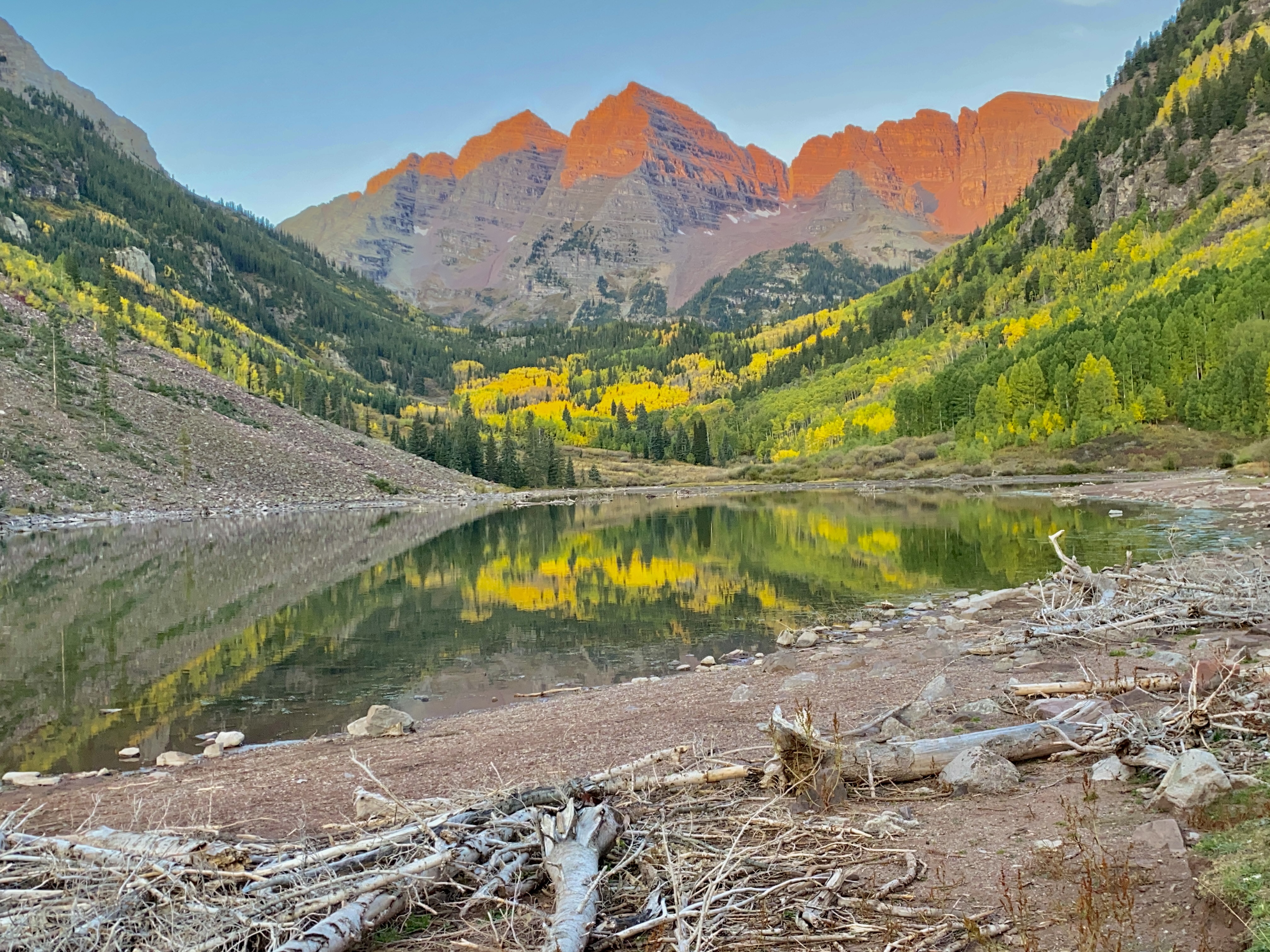
To this date, Martha and I (and DaLea has joined us for the last two trails in Iowa and West Virginia) have ridden all 35 of the Rail-Trail Hall of Fame trails.  This trail in Maine is the 36th inductee.  When voting week came in 2022, we inundated the voting with votes for the trail—we are allowed multiple votes, which we took advantage of—because we really wanted to go to Maine, especially eastern Maine and Acadia National Park, for a biking vacation.  When the trail won, we began our planning for lodging because places fill up so fast around Acadia National Park.  We were fortunate again that Martha was on the ball in locating good places to stay and planning our on-road bike route to see several light houses on Maine’s eastern coastline.

DaLea & Joyce, South Bubbles Rock

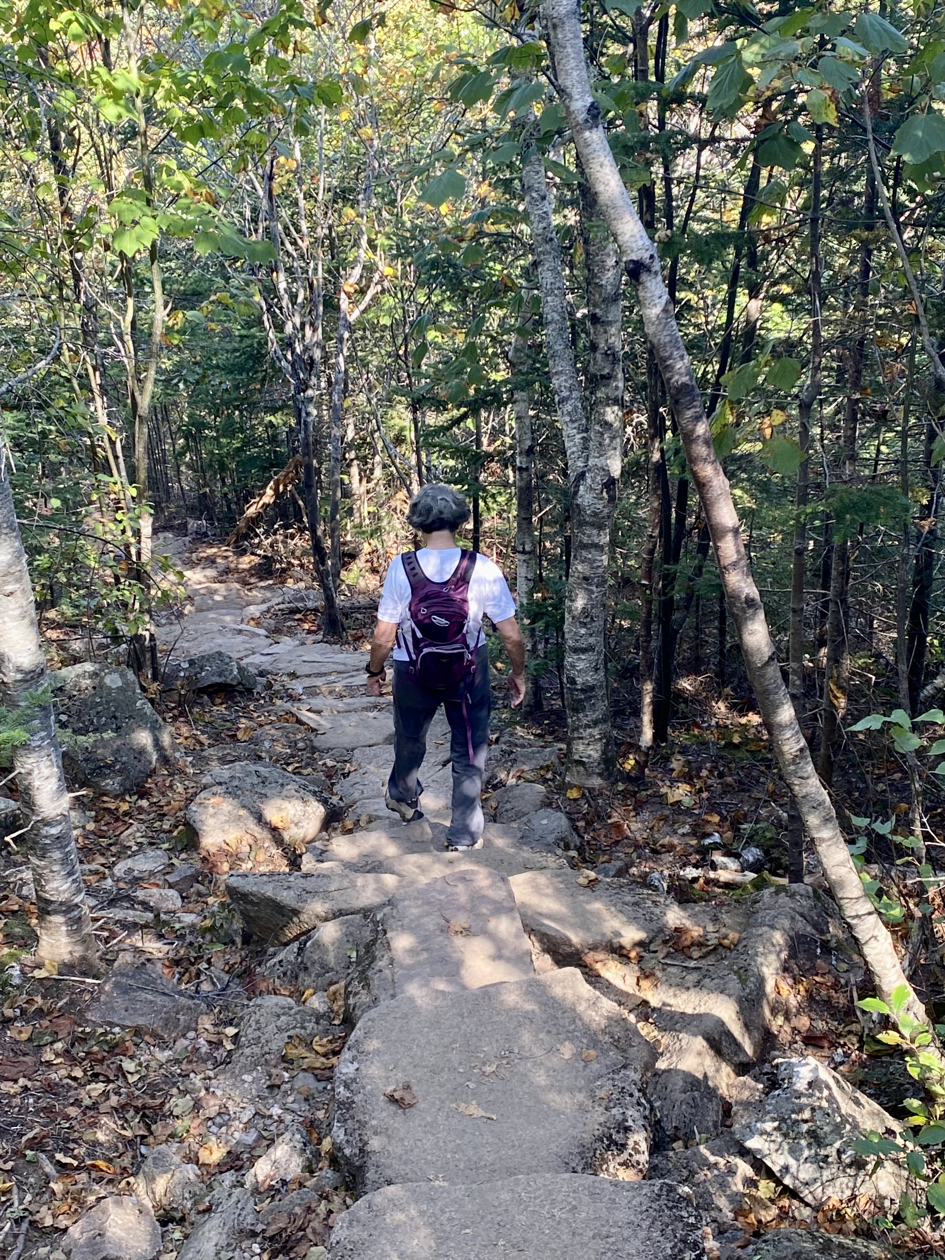
We decided to start the trip by flying to Bangor, Maine, where Martha and Ed met DaLea and me with their truck and camper and drove us all an hour or so to Hadley’s Point Campground in Bar Harbor, just outside Acadia N.P.  After Ed and Martha found their campsite and DaLea and I got checked into our convenient, clean, and sparse cabin, we headed over to Acadia for a hike on the South Bubbles and the North Bubbles trails. It was late afternoon but visibility was still good, so that at the two tops we could see other sections of Acadia and had enough time to explore around the big balancing rock at the top of South Bubbles. The two trail total hiking was a little more than two miles out and back, moderately difficult but quite do-able.  It was a great way to introduce us to Acadia! 

DaLea & Joyce @ C-Ray’s

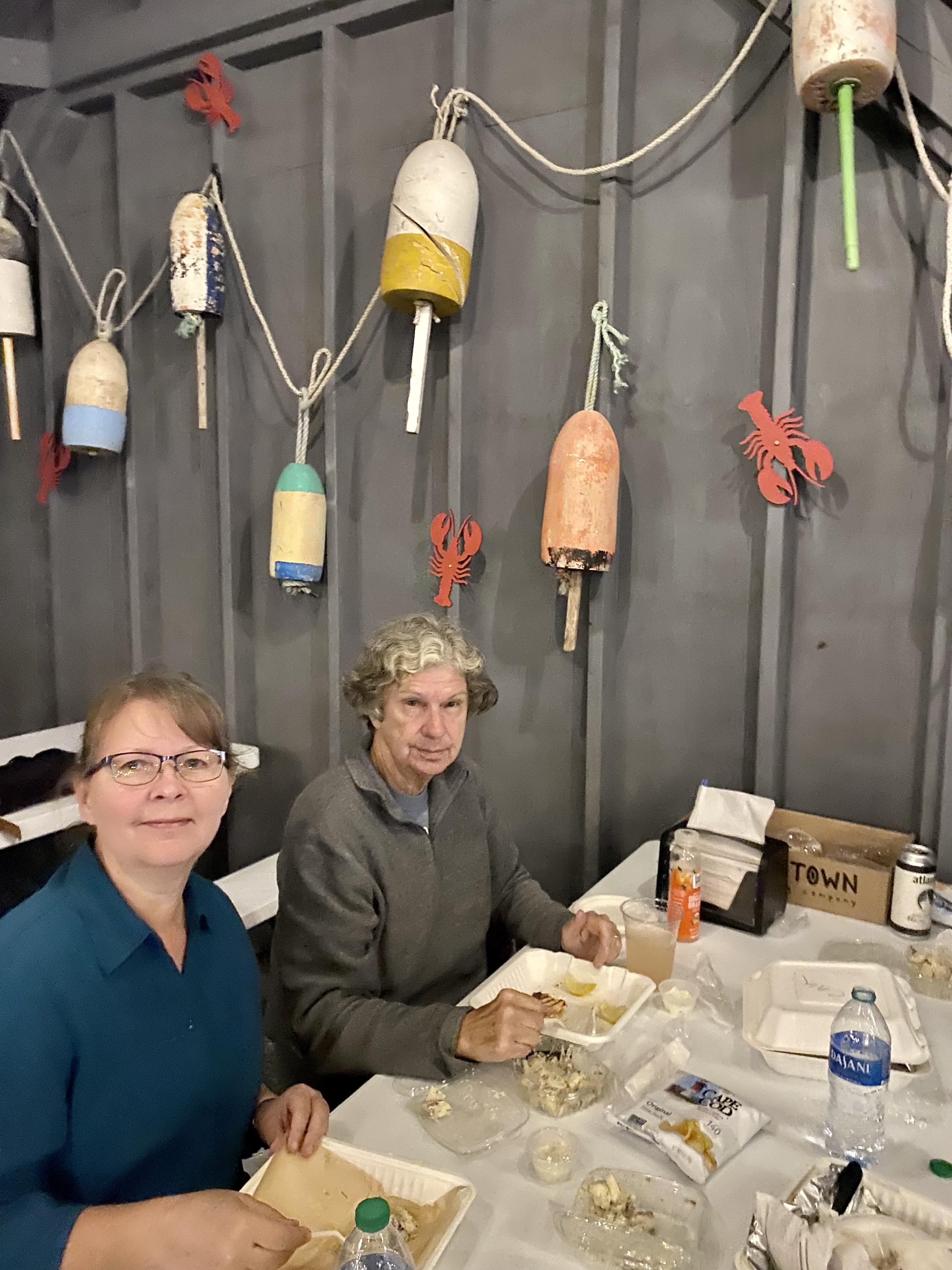
After the hike we went to C-Ray Lobster across from Hadley’s Point Campground for a delicious dinner of lobster roll and lobster panini sandwiches along with blueberry pie for dessert.  Good choices.  Back at the cabin, we surveyed the sparseness that I mentioned earlier:  we knew we were supposed to bring our own sleeping bags and pillows and wash towels, so that didn’t surprise us.  What we didn’t know was that for three quarters you put in the coin collector, you get seven minutes of hot water.  We learned to take time efficient showers!  Another sparsity was lack of any table or chairs or anywhere to put our suitcases, so if we wanted to sit down in the cabin, we had to sit on our beds.  But we will say that it was economically and geographically convenient for our main purpose of seeing the national park, so we are not complaining.

October 3:

Joyce Hiking down North Ridge Trail

On Tuesday morning we arose early—early for me anyway—and had a quick breakfast sitting on our beds in our cabin—food we had brought from home, except for the milk, which Martha kept in her camper frig and drove it over to us each morning.  Ed picked us up at 7:30 to drive into Acadia to the Ocean Path Trail, which we hiked on and enjoyed the coastline view.  It was just under two miles and an easy walk.  We ended up at Thunder Hole, a narrow place on the coast where the ocean makes a roaring/clapping sound as the tide enters the hole and hits the land and then flows back out. At that spot, we took the island shuttle back to the car and then drove to the top of Cadillac Mountain for a neat view of Bar Harbor and surrounding area.  Ed drove back down, while Martha and DaLea and I walked down the North Ridge Trail, a little over two miles.  It was a bit steep and rocky but pretty scenery all the way down.  I don’t think I would want to walk up the trail, so we were fortunate that Ed was willing to pick us up at the bottom. He hiked a little way up and met us on the trail, so he got to do a little hiking also. 

DaLea & Martha Biking on Carriage Rd, Eagle’s Lake

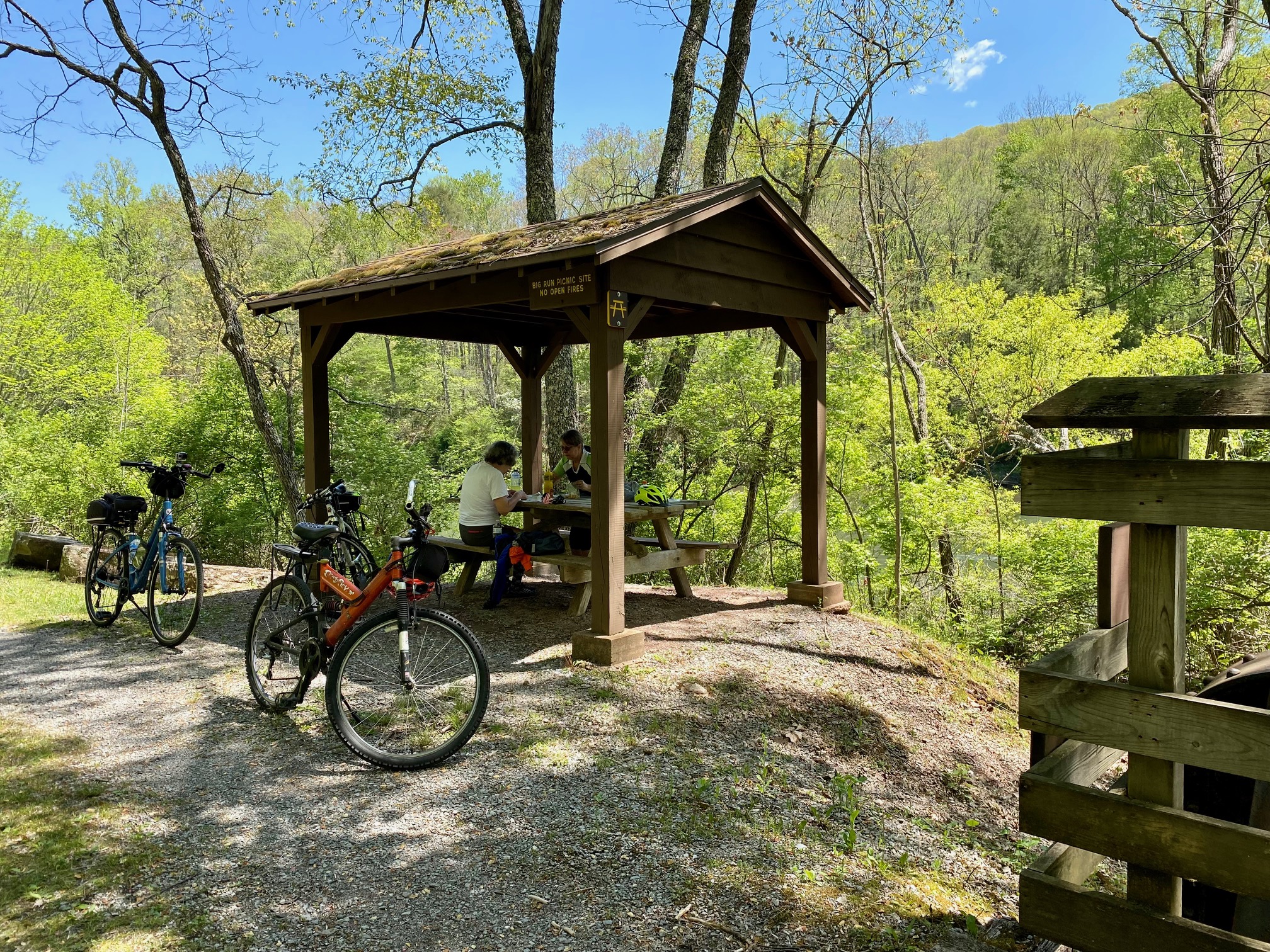
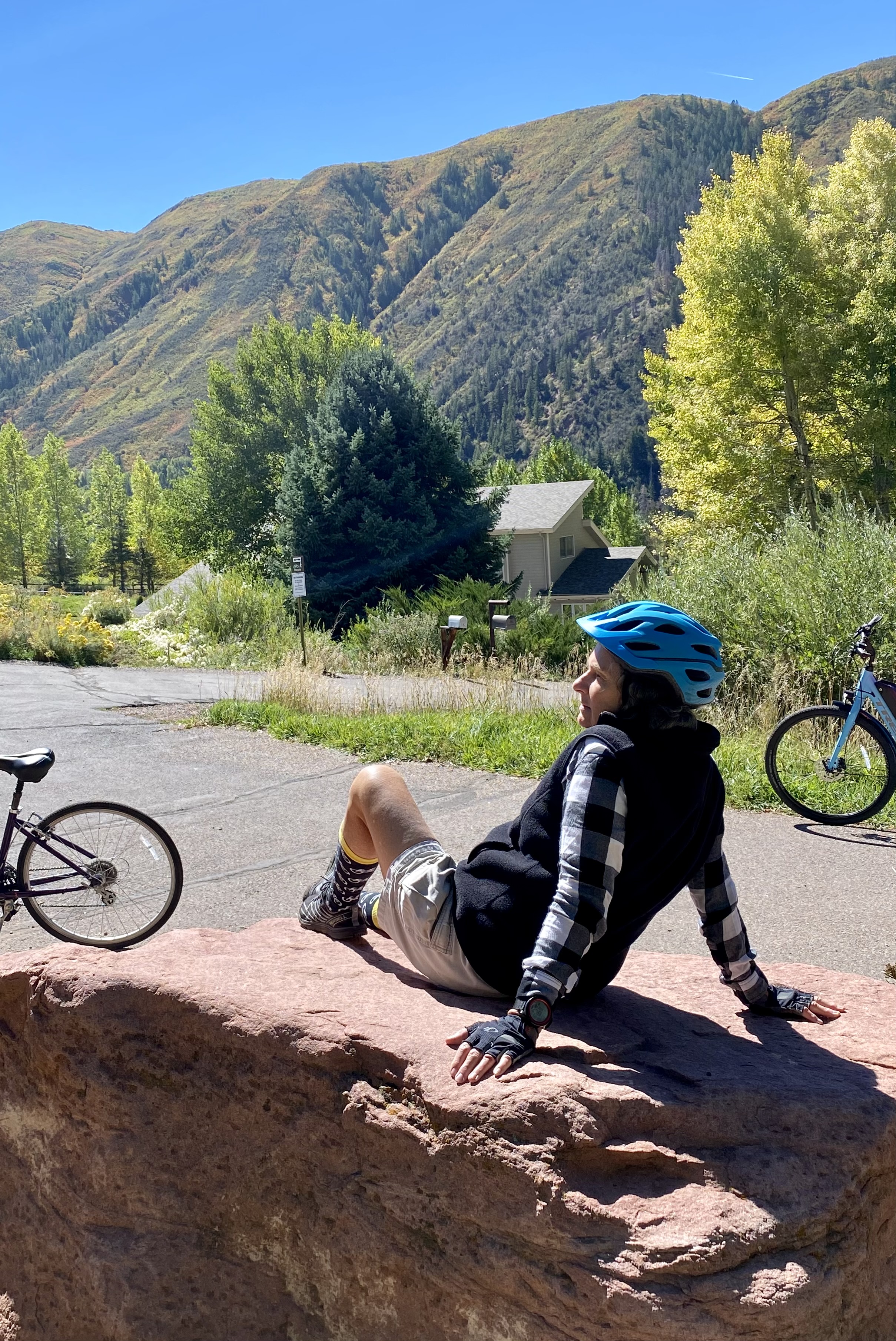
From there Ed drove us—thank goodness for Ed—to the Eagle’s Lake parking lot where we unloaded our bikes and began our 13-mile bike ride on the unpaved and a bit hilly Carriage Trail around Eagle’s Lake.  Most people we saw had rented electric bikes, so we have to pat ourselves on the back for our stamina in doing the bike ride on a regular bike using our own leg muscles and breathing capacity. We stopped for our sack lunch at Bubble Pond near the beginning of the ride.  On this trail, we picked up Aunt Betty’s Pond Loop, which was where most of the hills were.  The end of the Carriage Trail took us back to Jordan Pond House, where we intended to buy one of their popovers with ice cream, but they were sold out, so I settled for a blueberry popsicle instead.  We sat on the great lawn by the Jordan Pond House and enjoyed the view of the people and mountains.  (We could see where we were at the North Bubble trail top.)

DaLea on Jordan Stream Path

After our treats, we walked the Jordan Stream Path, about 1.5 miles, in the woods and enjoyed the scenery and the stone bridge that crosses the path.  It was a full day of being outdoors!  Great time!  Back at Hadley’s Point, Ed grilled us hamburgers and hotdogs, and we enjoyed dinner in their mosquito tented picnic table outside their camper.  (I might add here that today we deviated a little from our planned itinerary—substituted the Bar Island trail for the hike down Cadillac Mountain–and it all worked out well.

October 4:

Joyce Kayaking on Echo Lake

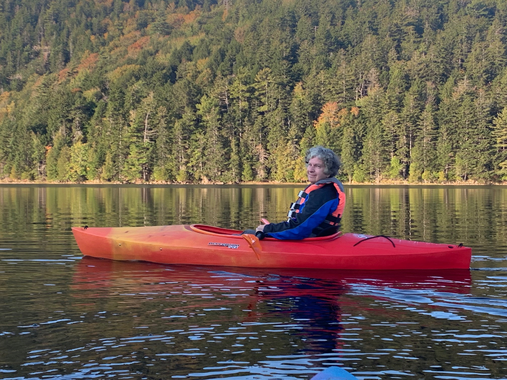
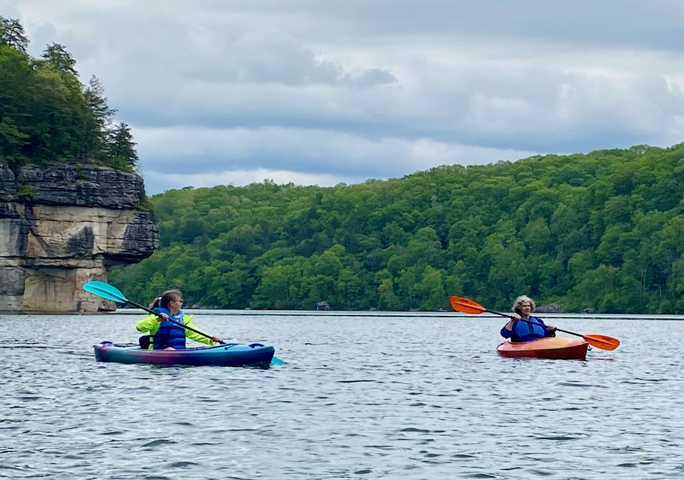
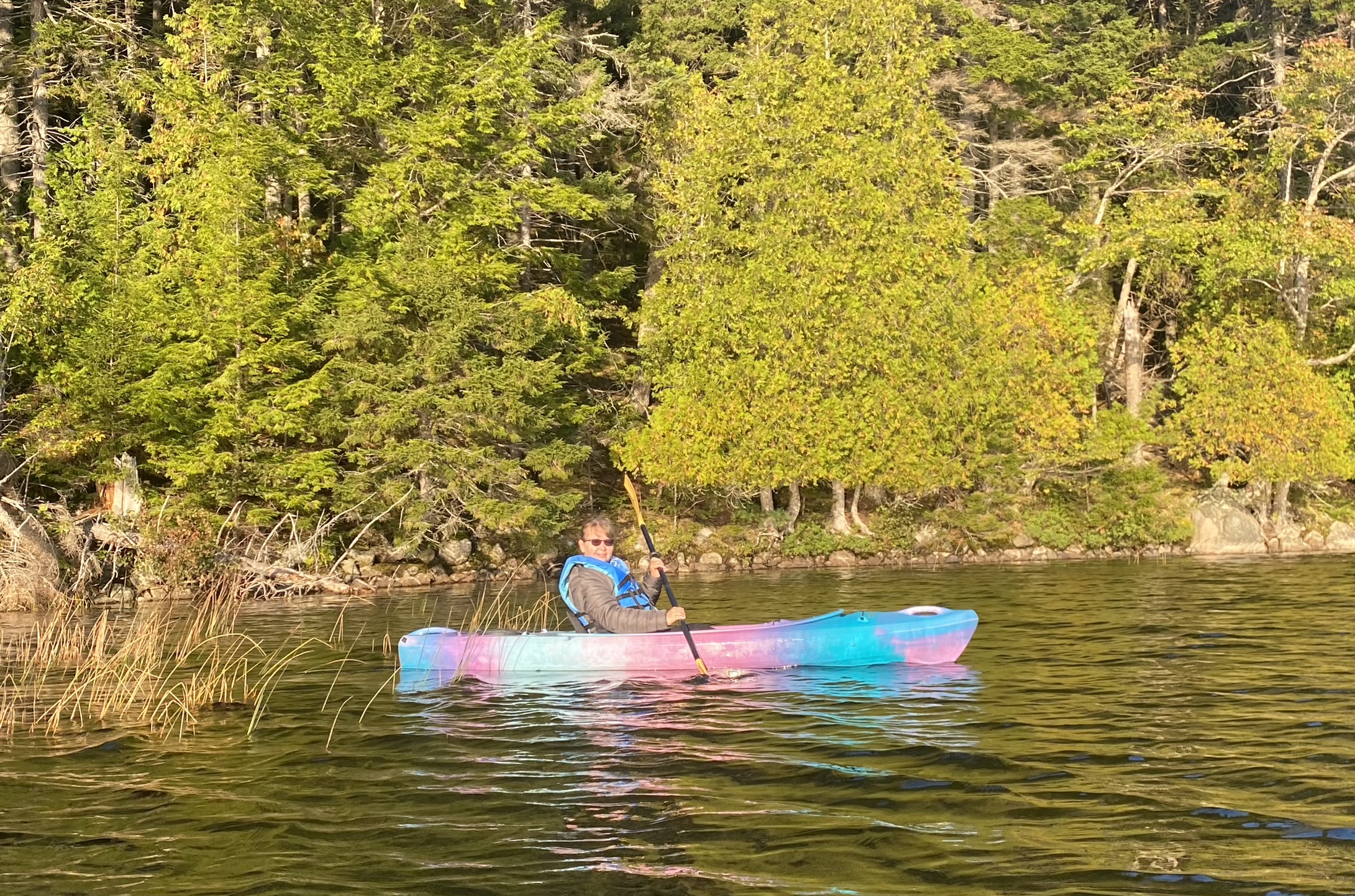
Wednesday morning awake time was even earlier than Tuesday, but it was well worth it.  We arrived at Ikes Point on Echo Lake by 7:30 am, ready to go kayaking in the early morning, hoping to see some Loons. It was a wonderful experience out on the calm waters, and we did see some Loons at one end of the lake and some neat cliffs at the other end of the lake.  We stayed out about an hour, nice and peaceful.  After Martha and Ed loaded the kayaks—once again thank goodness for Ed—he drove us to the Beech Mountain Trailhead on a different side of Mount Desert island from Bar Harbor, close to Echo Lake. 

DaLea, Martha and Joyce on Beech Cliff Loop Trail

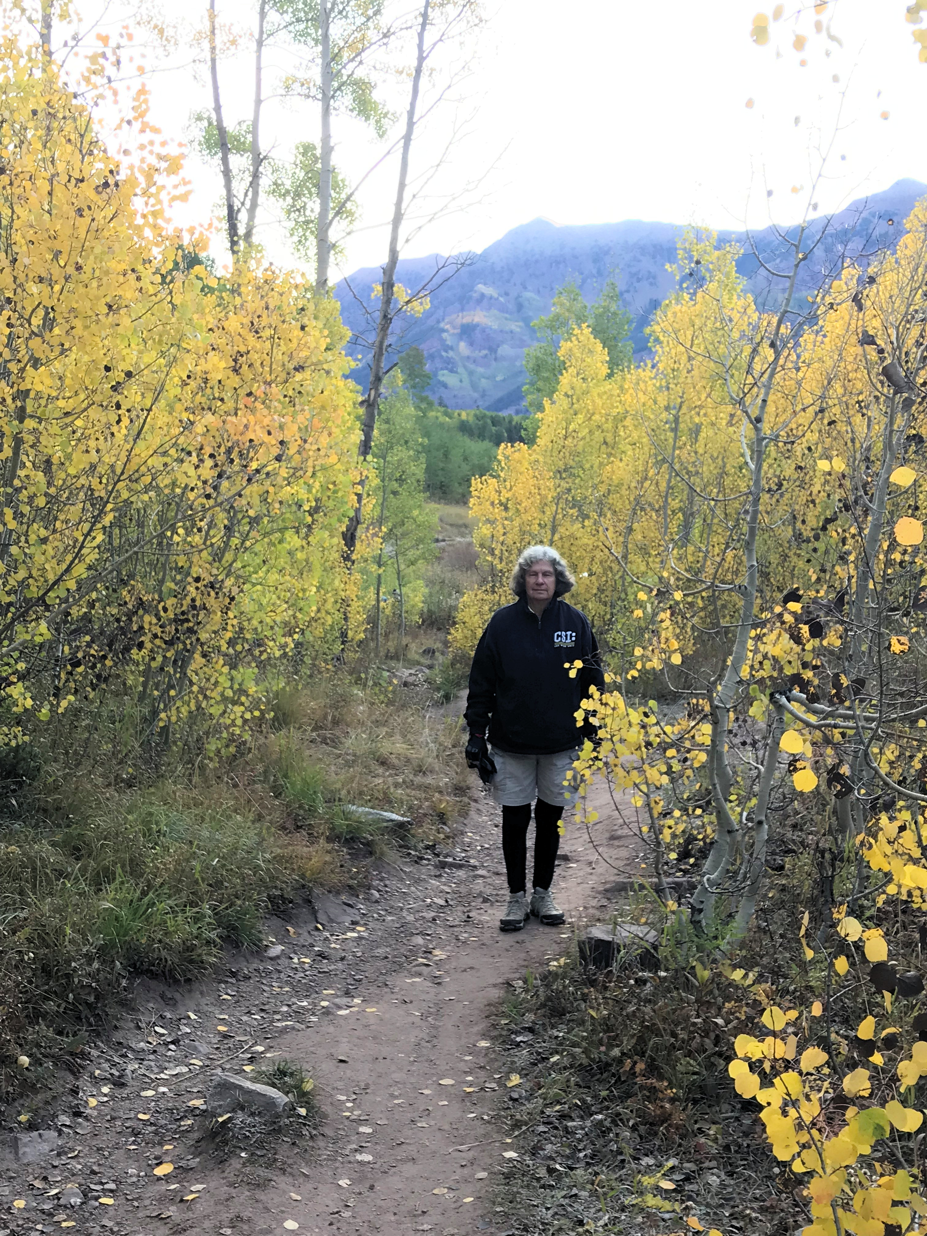
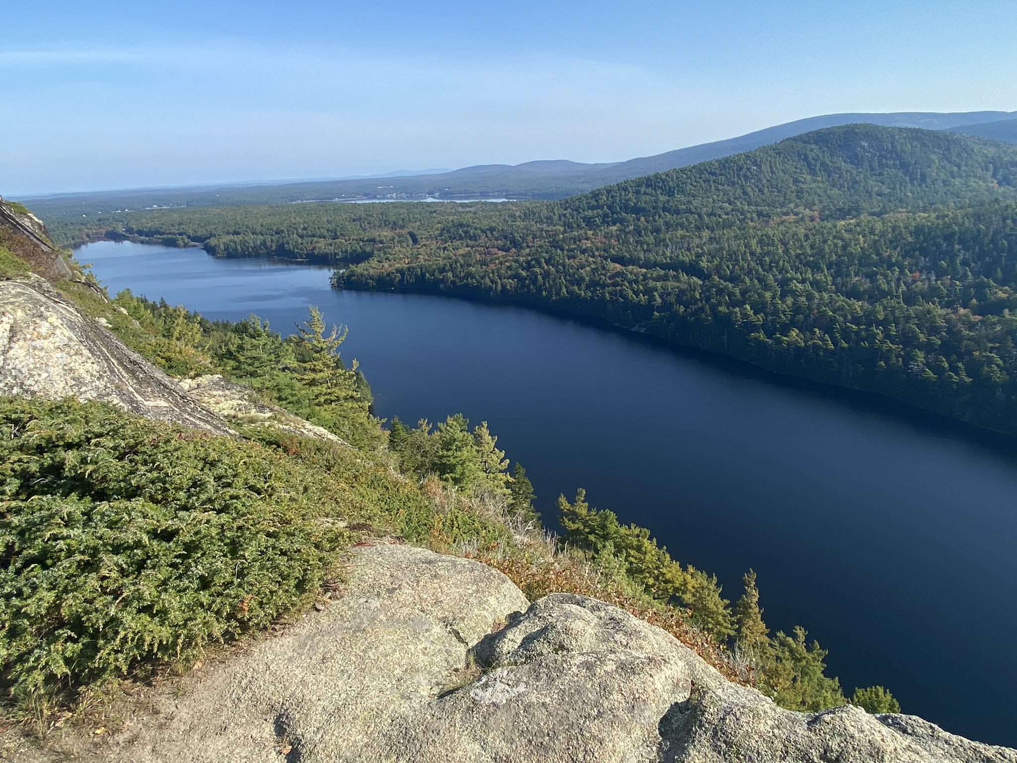
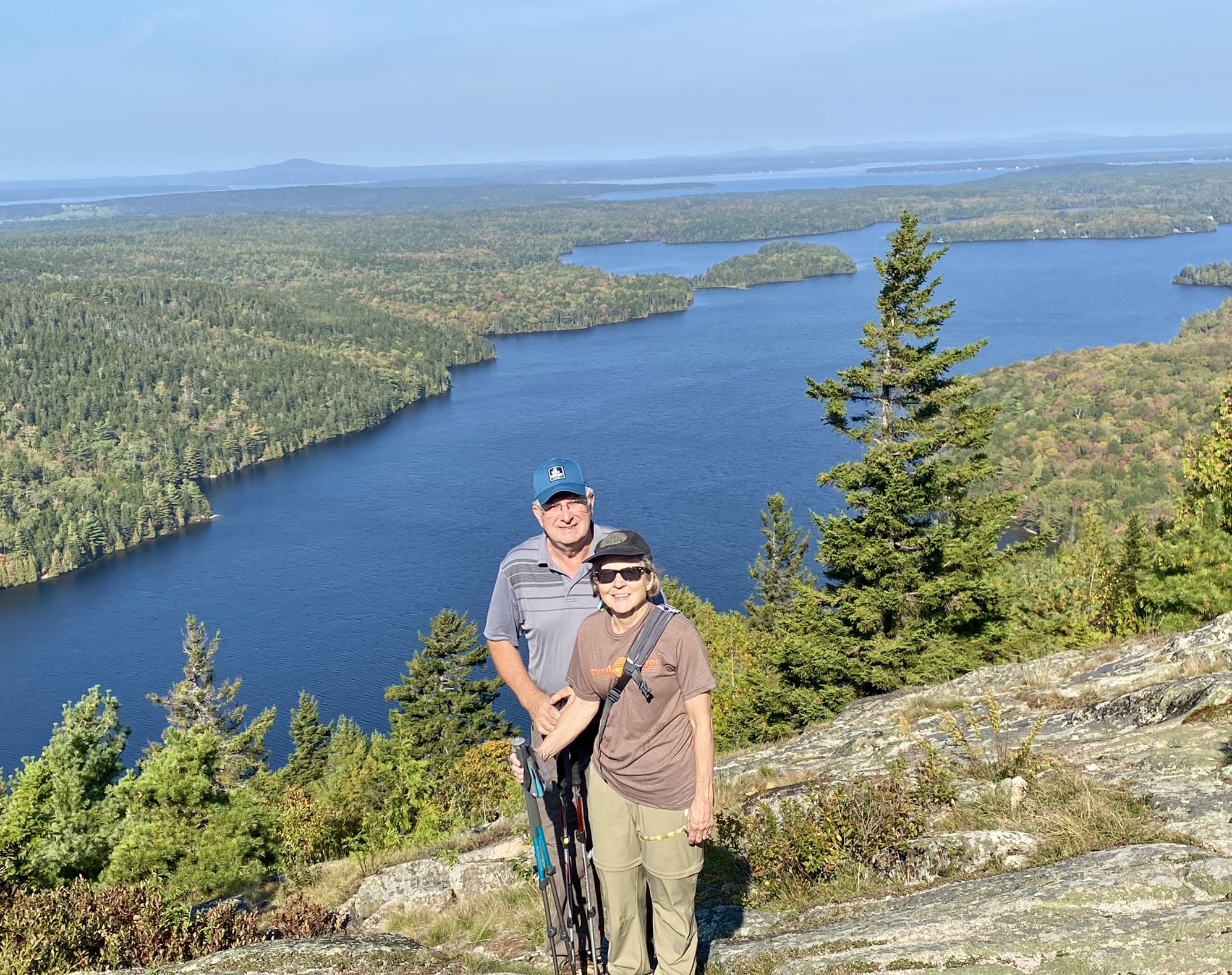
All four of us then hiked the Beech Cliff Loop Trail and the Beech Mountain Loop Trail, for a total of about two miles but with some moderate uphill climbing.  ( I have to add how lucky we were before we started hiking to drive to the wrong place to park because at the wrong place we arrived at a large recreational facility for youth groups that had the cleanest, nicest restrooms—an important factor at our ages—and the person in charge courteously let us use the facilities. Compare this to the parking lot outhouses, and you’ll understand my comment.)  From the tops of these hikes we had great views of the surrounding valleys.  The hikes were not real steep but very rocky and therefore quite strenuous because we had to keep our eyes on the trail just ahead of us so we would know where to take our next step on the accumulation of rocks.  After the hikes we drove to Bass Harbor, Maine, where we had some tasty claim chowder soup for lunch at Thurston for Lobster. 

Bass Harbor Lighthouse

After lunch Ed drove us all to the Bass Harbor Lighthouse.  It was so crowded on the access road, though, that poor Ed just had to stay in the truck with the traffic while the three of us walked to the lighthouse to see it and then walked back, and he did a U turn and gave up trying to see it for himself.  A small parking area at the lighthouse is the reason for the traffic jam.  On the way back to Bar Harbor, we stopped at a roadside place for a great ice cream cone.  Because of time shortage, we skipped the Hadlock Brook Loop bike ride on our itinerary, but that was okay.  We drove back to Acadia thinking we might go into the visitor’s Center, but it was way too crowded, so we went on to find a parking place for our Sunset Cruise with Acadian Boat Tours.  That went from 4 to 6 pm and was quite interesting.  The fog made it somewhat difficult to see, especially on the return part, but we saw several of the nearby islands and heard some good history from our tour guide.  I’m glad we did that.  After the cruise we had dinner in Bar Harbor at McKay’s Public House.  Comment here is that even though we were not there in the “tourist season,”  there were plenty!!! of tourists visiting Bar Harbor in early October.  My memory of this says “don’t go to Acadia in the summertime” unless you want to be with the crowds everywhere.  Parking was a problem even for us in October.  I can imagine the problem in the summer!

October 5:

DaLea, Martha & Joyce, Portland Lighthouse

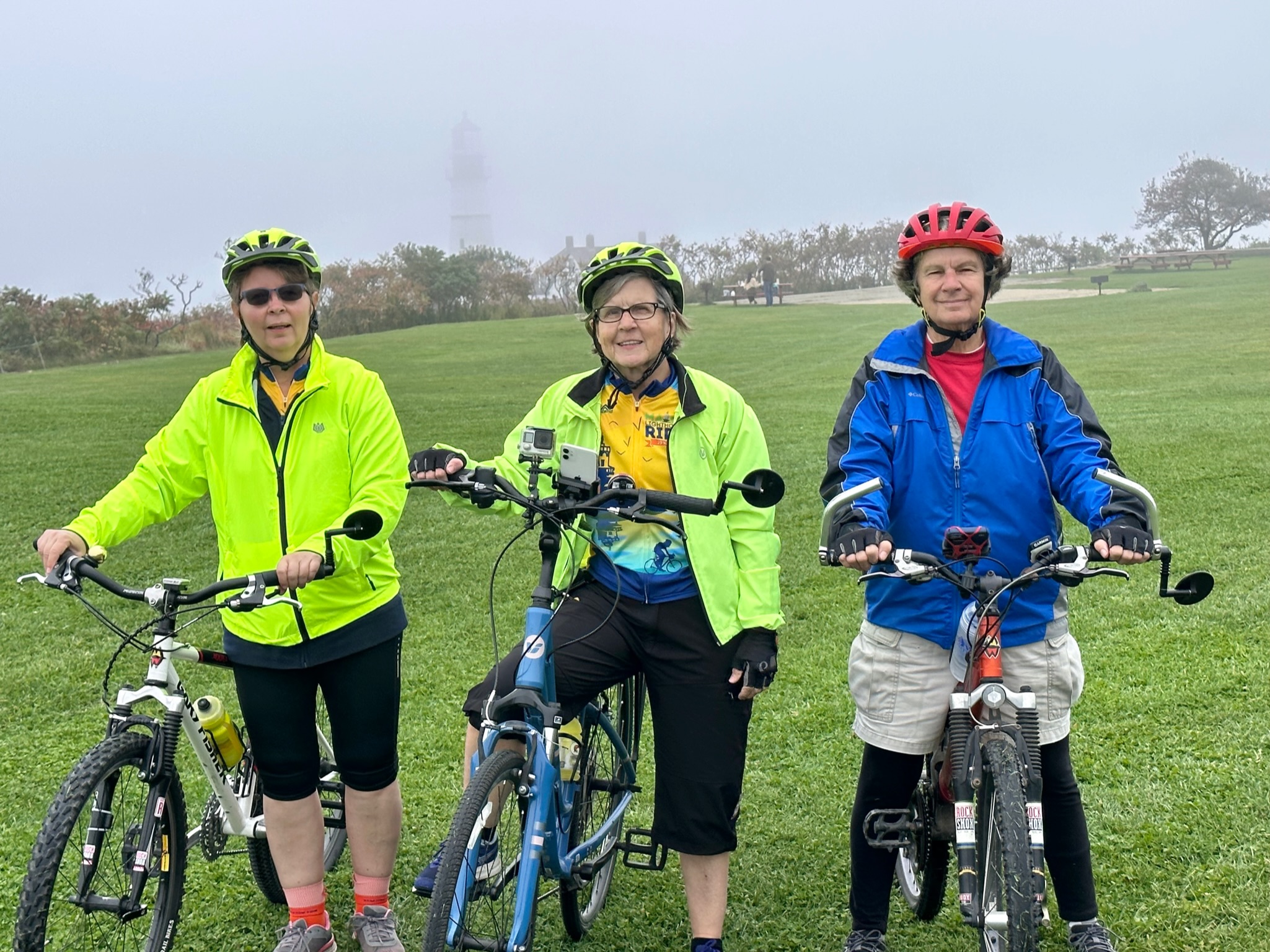
Thursday morning.  Time to check out of Hadley’s Point Campground and move on to the real purpose for the trip—to ride our bikes on the Eastern Trail.  After a three-hour ride to South Portland to the Portland Head Lighthouse, we unloaded our bikes, had a picnic lunch, walked around the lighthouse area, and then left Ed as we took off for the Spring Point Lighthouse.  We had to deviate from our planned bike route today and Friday, since rain was expected on Saturday, so we moved the rides from Saturday into Thursday’s and Friday’s rides.  This means that I don’t have my itinerary as a reference for how far our rides were this day, so I’ll have to guess.  And I don’t have my odometer with me to refer to either.  Between the starting point and the first lighthouse, which was neat because it was way out on a huge rock walkway, was probably 8 miles.

DaLea, Martha & Joyce @ Bug Lighthouse

We were on city streets, not on any trail, that Martha had mapped out with an app on her phone, following part of the pathway of the Maine Lighthouse Ride, which had been the week before and about one hundred miles long.  The streets weren’t really crowded, though, so it was okay.  Leaving the Spring Point Lighthouse, we headed for the Bug Light Lighthouse, a neat smaller white lighthouse with a black top, located also in South Portland, Maine, also known as Portland Breakwater Light, with intricate architecture resembling Greek Revival architecture. It was a cute little lighthouse, and its location is the start of the South Portland Greenbelt Pathway, which leads into the Eastern Trail.

Scarborough Marsh along Eastern Tr

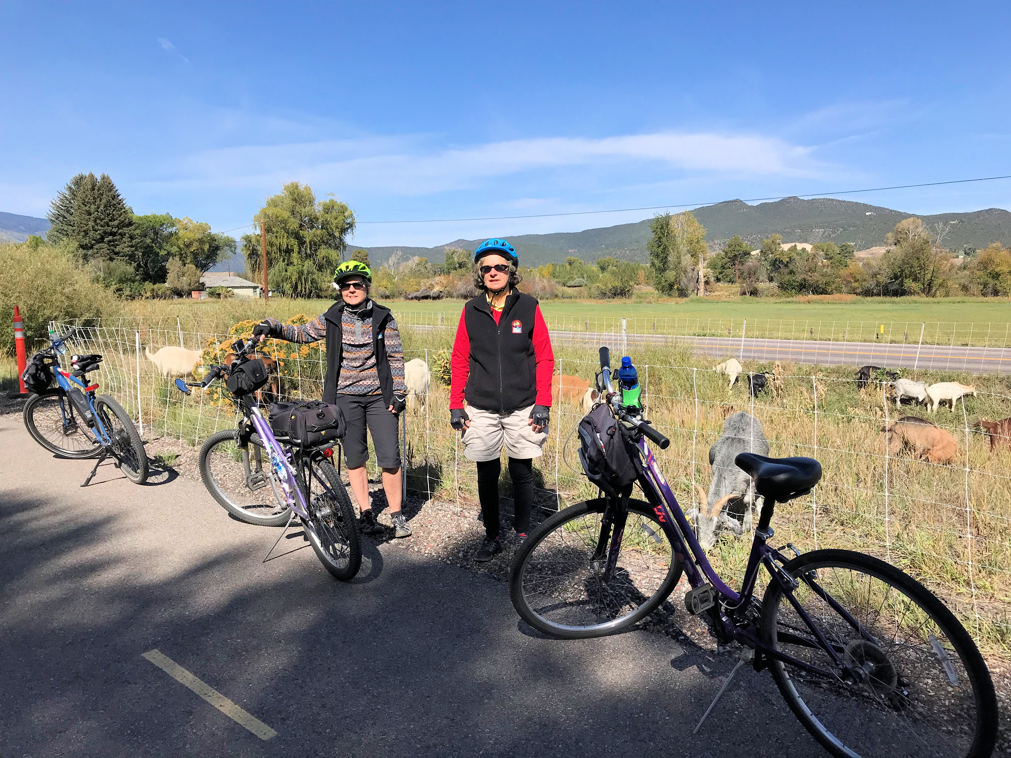
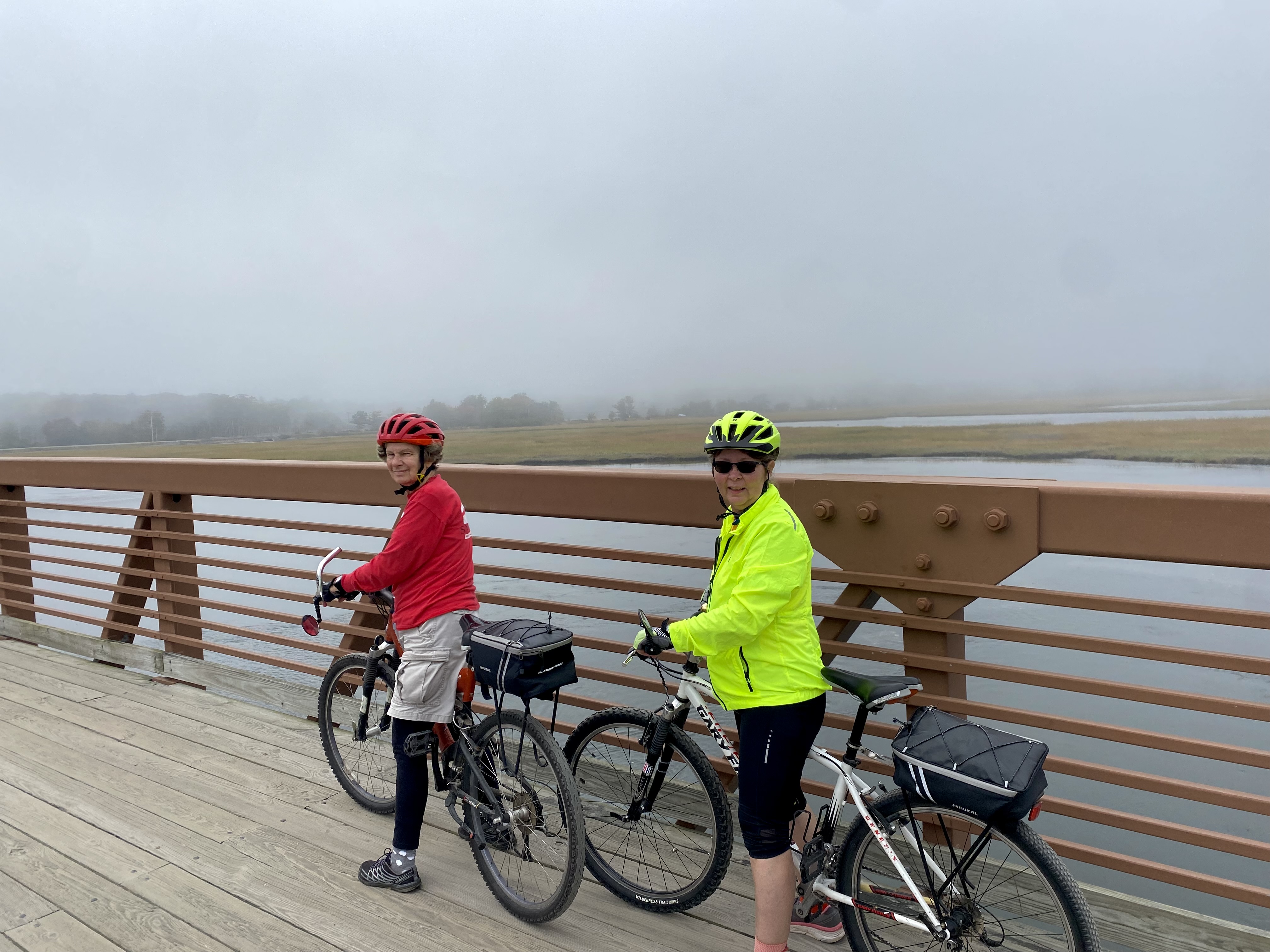
So that’s where our official start of the Eastern Trail occurred.  It was about 3 or 4 in the afternoon, and we rode about seventeen miles, about half of it on the no-motorized traffic Greenbelt and the other half on regular roads, which was a little hectic at times due to traffic.  Martha’s app guided us well.  On the way we went through the Scarborough Marsh—the state’s largest salt marsh conservation area, which was interesting geography and saw a few birds.  

Joyce & DaLea, Scarborough Marsh, Eastern Trail

According to the trail information, we rode along a seven-mile stretch of sandy beach, but I honestly don’t remember any beach along the trail—only on Friday when we left the trail to ride to the Goat Island Lighthouse.  So maybe we saw it, and maybe we didn’t.  If we did, it must not have been very spectacular to me.  We finished this day’s ride at the Paradise Park Campground, where Ed had already set up their camper and checked DaLea and me into our cabin.  This cabin was like a “honeymoon suite” compared to the other one—we had separate bedroom, a shower with free hot water, a refrigerator, a couch, a table and chairs, and a smart TV!  After settling in, we all drove to a nearby pizza place Martha found on Yelp and then to an ice cream place for dessert.  Great choices for food.

October 6:

DaLea & Joyce on Eastern Tr

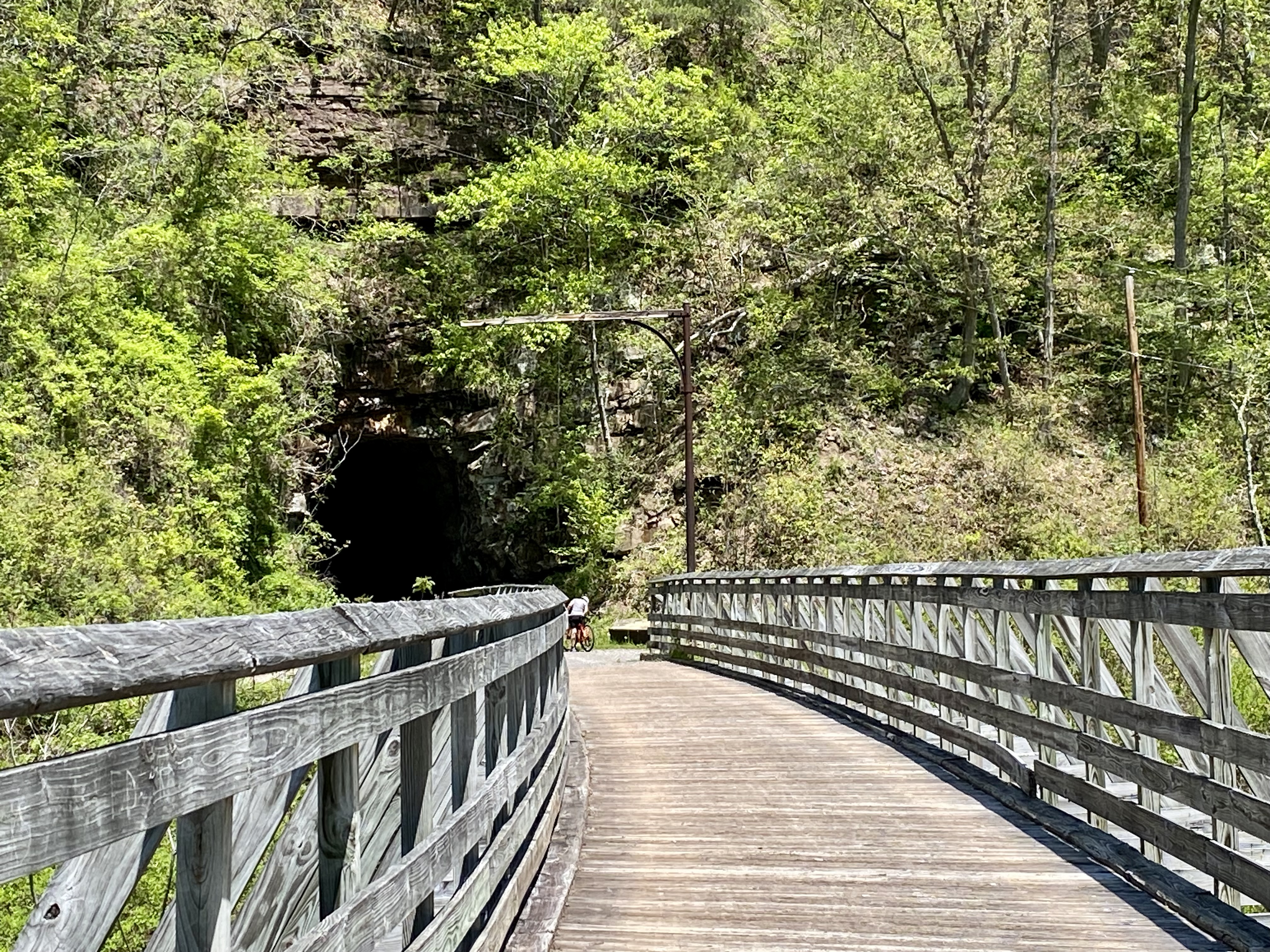
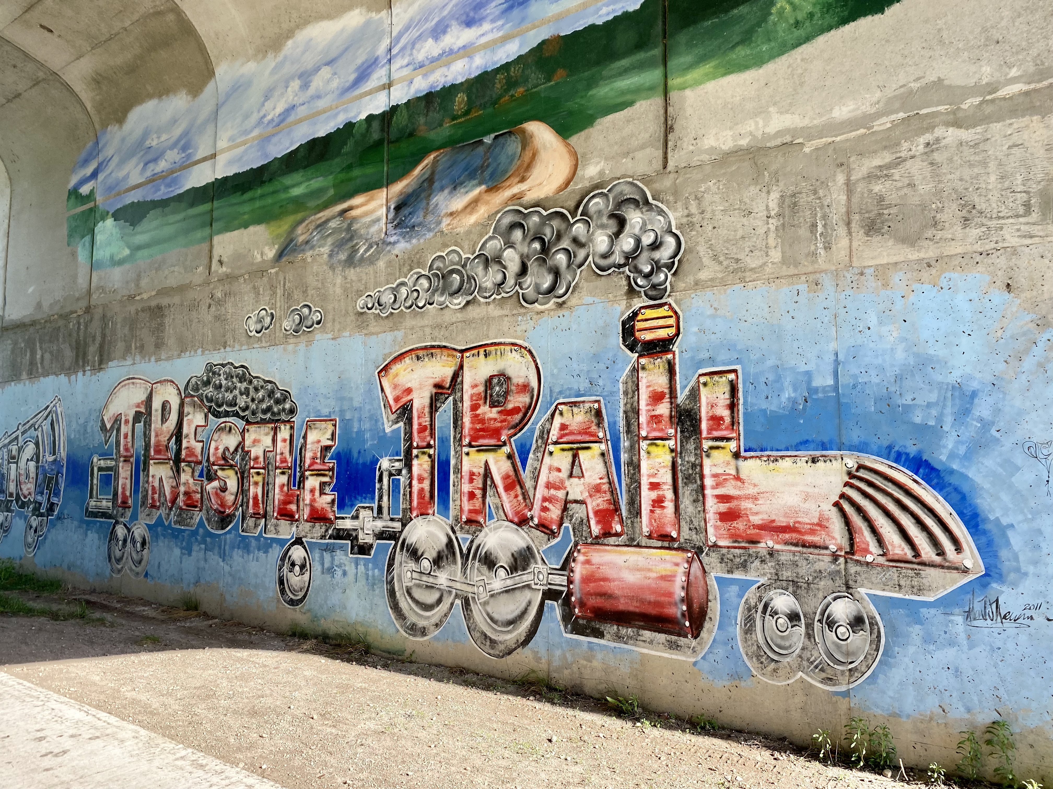
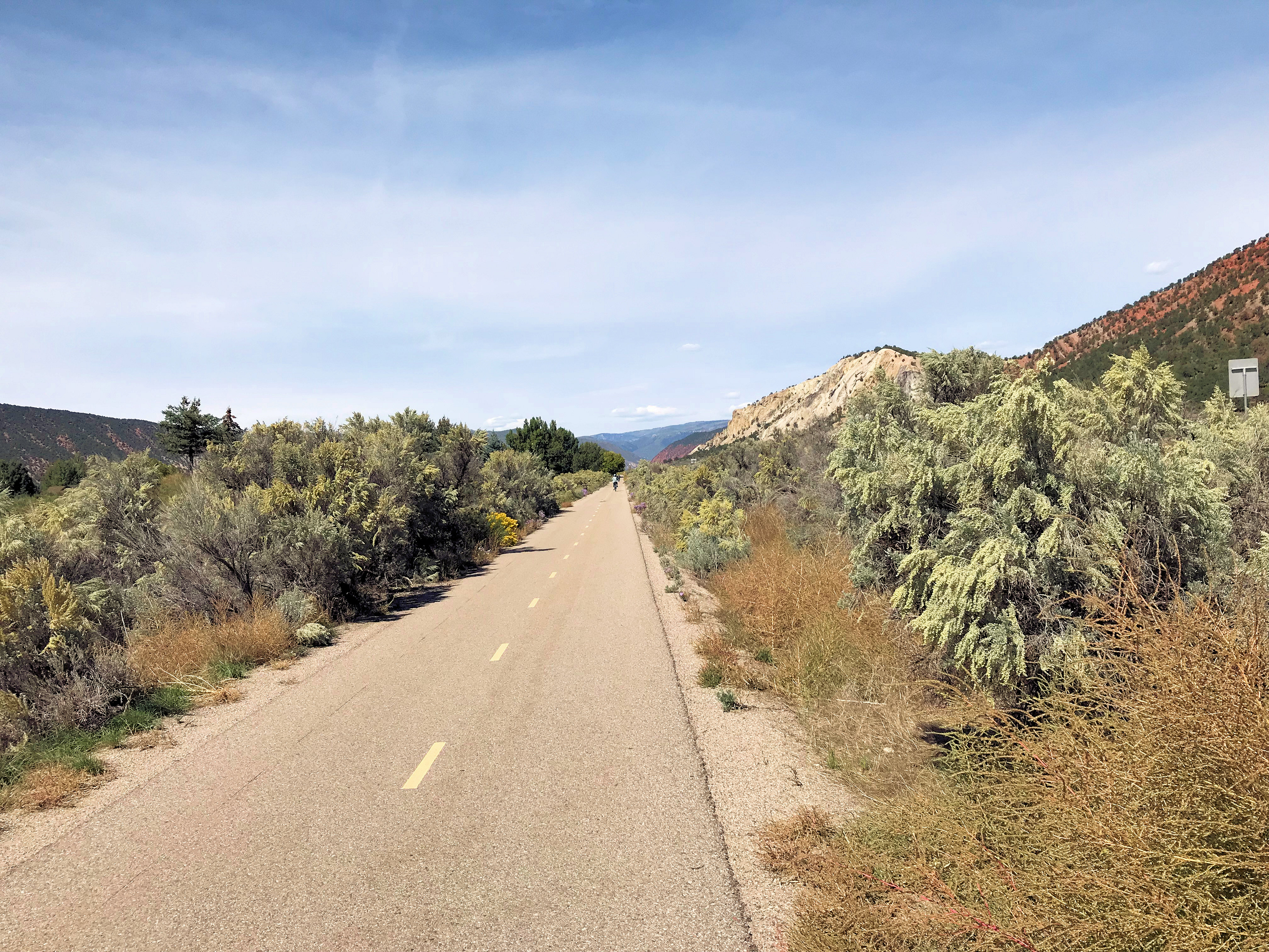
Friday morning, and our last day of bike riding.  Note that the Eastern trail is on the site of the former Eastern Railroad connecting Boston to Maine (1840’s).  Only about 24 miles of off-road trail are completed of the planned 65 miles, which is supposed to extend down to the New Hampshire border.  When completed, it will be part of the 3,000 mile East Coast Greenway, which will connect trails from Maine to Florida, and part of the New England Rail-Trail Network, which aims to unite the regions six states of Maine, Vermont, New Hampshire, Massachusetts, Rhode Island, and Connecticut.  The three of us agreed that if we are still around and able to, taking this trail in ten years would be another welcoming experience.  For now, though, we are content to do the 24 miles completed. 

Church in Kennebunkport, ME

Ed dropped us off near where we finished the trail yesterday, and we rode the trail for another seven or eight miles until we had to leave the trail a couple of miles early because we wanted to head for Kennebunkport, Maine, in order to continue our lighthouse excursion.  We were on public roads from them on, following Martha’s app, and had some hills to take on, but we did it!  I can’t go as fast as them, and they told me I needed to wear something brighter so that they can always spot me in their rear view mirrors.  Nice to be looked after.  We went for about ten miles through the coastal towns and had great views of the Maine east coast.  Eventually, we reached our goal for lunch—the Cape Pier Chowder House near the Goat Lighthouse, which due to fog was unfortunately not very visible, but the atmosphere in the area was memorable. And thank goodness they had a public restroom.

Ocean View, East Point Sanctuary

Leaving there, still on public roads, we headed for the East Point Sanctuary, approximately another ten miles, where we were taking a little walk to try to see another lighthouse in the fog and then meeting Ed.  At one point along the way, we came to an old cemetery and stopped to take photos of the gravestones for Dalea’s latest adventure in photographing and recording for Billiongraves.com.  When we met Ed, we loaded our bikes on the truck one last time and headed back to Paradise Point Campground.  We all agreed to go back to the same pizza place for dinner and to the same ice cream place for our desserts.  Too bad I can’t remember the names of either, but they were both good enough to visit twice! (Note from Martha: The pizza place was Pizza by Alex and the ice cream place was Fielder’s Choice).


October 7:

LL Bean Flagship Store

As predicted, when we woke up, it was raining, or at least sprinkling, at Paradise Park Campground.  We packed our suitcases, rolled up our sleeping bag and pillow, and gave it all to Ed and Martha to pack for the trip home today.  We had decided to sleep in a little, just a little, and spend our time this morning going to the L.L. Bean store in Freeport, Maine, on the way to the airport.  In my perspective, it was just like another large sporting goods store.  I looked at some other hiking shoes but didn’t find anything that I liked that fit, so I didn’t buy anything except our lunch from one of the many food trucks in the parking lot.  It was fun, though.  Then at the airport, DaLea and I passed the waiting time putting together a jigsaw puzzle of Maine that was just half worked on in the airport waiting area.  That was different and fun.  Our flight home was uneventful, and Ron and Johnny picked me up and Barry picked Dalea up, and we arrived home safely after another great adventure together.  I’m so glad I asked DaLea to come to Iowa with us last year.  She’s a wonderful roommate and cycling companion, and she and Martha get along well.  We have a good threesome.

Now I’m writing this a month later while I’m in DC for the arrival of our new little grandson Owen Jackson Swofford.  It’s been a busy month since the bike trip, especially because Ron and I went to Salt Lake City for the last week in October.  I feel like I’m gone a lot this fall.  And it isn’t over—for two weeks I’ll be back here in DC to help take care of Olivia and Trevor and hold Owen, and Ron and Johnny will be coming up also for a few days.  Henry and Daneille are good to have us up here so often.  We like coming.

Note from Martha: Joyce did such a good job documenting our journey to the Eastern Trail that I decided not to post a duplicate entry. Instead, I added the photos and videos to enhance her post.

Greenbrier River Trail, May 8 to 13, 2023

Martha, Dalea, & Joyce, Greenbrier Trailhead

I rode this trail with two friends—Martha Wicker and Dalea Snell.  Wonderful companions on the trip!  Logistics summary:  Dalea and I drove to our place in western North Carolina and Martha and Ed stayed at Bear Den Camp Ground on the Blue Ridge Parkway.  They picked us up on Tuesday morning at the bottom of Swofford Road to drive us to West Virginia.  We left my truck at the Brownie house at the end of Swofford Road.  They brought us back there on Friday evening, and on Saturday Dalea and I drove back to Atlanta. Interesting fact–Bear Den Campground is actually at the top of the mountain behind our house, but it takes 30 minutes to drive there on the state roads and the parkway.

Greenbrier River adjacent to Trail

The Greenbrier River Trail is definitely one of my favorite trails of all the Hall-of-Fame rails to trails, primarily because of the scenery—the many wild flowers along the trail and the presence of the Greenbrier River almost constantly at our side.  Of course, the flowers could be because of the time of year we rode the trail, but I would guess that there are several flowers no matter the season.  The trail was hard packed crushed gravel amidst the dirt but gave no problems with balancing or thorns in the trail debris.  The one part that is paved on each side of Marlinton was nice, except that either because of the pavement or because of its proximity to the town, broken glass was strewn on the trail and almost unavoidable to miss. 

Good Samaritans Helped Change My Tire

Unfortunately, I picked up some of the glass and ended up with a flat tire about a mile out of town, going south. A group of riders were not far behind us, and they graciously helped me change the tire because I was having so much difficulty getting the tube out of the new tire. None others picked up the glass, but the riders in the group knew immediately where I had picked up the glass because we all saw it when we came upon it.  They reported it to someone in Marlinton, so hopefully it will get cleaned up before anyone else gets a flat.  The two young men who helped me were indeed a blessing to have come along just at the right time and being willing to delay their ride and help me.  That’s what I like about biking—good people!

Joyce Pumping Water on Trail

Other than the glass, the trail was well kept and deserves the Hall-of-Fame recognition.  Fallen trees had been removed from the trail, outhouses with toilet paper and hand sanitizer were available along the trail, picnic tables and benches could be found along the trail, the width of the trail is suitable for riding side by side or passing other riders coming in the opposite direction, mile markers consistently told us where we were, water pumps were available near the two or three campsites we saw, tool stands were located in Marlinton and seems like one other place along the trail.  And nature provided us with pleasantries as we rode—a flaming orange azalea and other pink azaleas could be seen in places, all the purple, pink, white, and yellow wildflowers (I can’t remember all their names—Martha and Dalea know them; I just enjoy them) and their butterflies accented the trail, frequent creek crossings and little waterfalls made good photo stops.  Little chipmunks could be occasionally seen, birds could be heard especially in the morning hours, and the greatest treat was the bear cub who crossed the trail in front of us twice, ran along in front of us for a while and then ran in the nearby field trying to escape from our presence.  Too fast for a photo, but Martha was able to turn on her video camera and get a glimpse of him running away.

Dalea & Joyce @ Bridge

The schedule we settled on was perfect:  the first day we rode about 37 miles, the second day about 31 miles, and the third day about 11 miles—79 miles in all, and all a little bit downhill.  Nice elevation change.   We started in Cass, rode to Watoga State Park (right on the trail!) where Ed and Martha camped in their RV camper and Dalea and I stayed in a park cabin, and then the next day continued south from the Park to the Anthony Trail Access.  On the third day we started at the Anthony Trail Access and rode to the finish line in North Caldwell.  We have to admit that we slipped past the ”do not enter” part of the trail at the end because we had talked to a couple that day who told us that the trail was completed following the required work done after the flooding and who had been told by one of the workers that they could skip the detour and take the trail out of North Caldwell to the Hopper Trail Access—the northern point where we were supposed to have taken the detour south to North Caldwell.  Once we arrived at the Hopper Trail Access and saw the steep hill that led to the detour, we unanimously voted to slip around the barrier and stay on the trail.  It will be good when the trail is open all the way; we actually couldn’t see any reason for the trail not to be open on the day we took it.  

Joyce & Dalea @ Droop Mtn Tunnel

Over the course of the entire trail, we got to ride through two tunnels, one on the first day and one on the second day.  They were not long, but it’s always fun to have to pause to turn on the head or bike lights, remember to remove our sunglasses, and experience the darkness of the tunnel.   Ed, Martha’s husband, patiently and graciously transported us and our bikes to and from the starting points.  We told him he was indispensable, and we meant it!

Joyce @ Arrowhead Trail Fire Tower

Along with the riding, we had some other planned activities.  We took a hike at the end of the first day on the Arrowhead Trail up to the Anne Bailey lookout tower at the top of the mountain and were treated to a wonderful view of the Greenbrier River valley.  It was a rather steep hike—call it moderately strenuous—but it was well worth the hike.  Only about two miles round trip.  It was just that after riding 37 miles we were a little tired.  We went back to their camper and had a delicious cookout that Ed had prepared for us.  On the second day of riding we stopped shortly after lunch and rode with Ed over to the Greenbrier Resort in White Sulphur Springs where we walked around on their lovely grounds and then took the Bunker Tour to learn about the construction of the 1962-1992 location of Congress’ secret escape from a possible nuclear war.  It was well worth the trip!  The location of the Bunkers was revealed through a leak to the Washington Post in 1992 in an article entitled “The Last Resort” if any reader wants to read about it.

Joyce Paddling behind Waterfall

We used Martha’s very detailed, well-prepared itinerary for our trip, and Dalea and I were most grateful for the work she put into it.  She built in ice-cream breaks on all days, had us stopping at the New River Gorge Bridge in West Virginia on the way up and New River State Park on the way back where we had two different spectacular views of the New River valley and bridge. One of the great side trip events on the way up on Tuesday was our hour-long kayaking excursion at Summersville Dam. She and Ed had brought along their three kayaks, paddles, and life vests for a wonderful experience out on the lake.  We were able to kayak over to a waterfall and even kayak behind the waterfall.  It was great!  Along the trail, she picked out picnic lunch places next to waterfalls on the trail, zeroed in on Watoga State Park for a scenic lodging place, allowed us plenty of time to leisurely ride the trail and stop for photos, and yet made sure we were able to do all that we wanted to do in addition to the riding.  On the first day she had a 45 minute “free time” allowance at the end of the day, supposedly before our 2 mile “moderately” strenuous hike. When I asked on the drive up why she had done that, she said we’d need it to get ready for the hike.  Either coincidentally or because I was the one who questioned the need for “free time,” I was the one who got the flat tire and who used up the 45 minutes changing my tire.  Consequences come when we doubt her wisdom in creating our itinerary!

Celebrating our Completed Journey

Martha and I have ridden all of the Hall-of-Fame rails to trails, and in thinking about them all, I get nostalgic thinking of the many neat trails that I will ride again if opportunities appear, but I must still say that this is one of my favorite because of the isolated and beautiful scenery. In my mind, West Virginia is a hidden gem. Ron and I and Ed and Martha rode from Cass to Marlinton back in 2006 when we first started riding the Hall of Fame trails, and I was eager to do those same miles again plus the rest of the trail this year and to take my friend Dalea on this most enjoyable adventure. 

Greenbrier River Trail Photos

Greenbrier River Trail, WV (May 10-12, 2023)

Joyce & Martha @ Sharp’s Tunnel, 2006

In 2006, just after I retired, Joyce and I biked the upper section of the Greenbrier River Trail from Cass to Marlinton with our husbands. I don’t recall a lot about the trail except Sharp’s Tunnel and my husband struggling to finish the last 10 miles due to a rear tire that was almost flat. We were novice bikers at that time and carried no tools or an air pump for emergencies. A lot has changed in 17 years when we first biked the Greenbrier River Trail – we now carry tools, extra food and water, head lamps for tunnels, rain jackets, etc. Since we never got to ride the lower portion of the trail, we decided to revisit it this spring and bike the entire 77.4 mile trail from Cass to North Caldwell.

Bear Den Campground, NC

On May 8th, my husband and I drove our camper trailer to West Virginia, stopping the first night at the Bear Den Campground on the Blue Ridge Parkway. We picked up Joyce and one of our new biking friends, Dalea, the next morning at Joyce’s farmhouse near Linville Falls, NC. Since there was no place to turn the camper around on the road leading to Joyce’s farmhouse, we arranged to meet them at a small church parking lot on Hwy 221. Originally, they had planned to drive down and drop off their luggage and gear, take Joyce’s truck back up to the farmhouse and then bike down to our camper. However, it was raining, so we had to unhitch the camper and Ed followed Joyce back up to her farmhouse where she left her truck, and then rode with Ed back down to the camper. After rehitching the camper, we were on our way about 8:30 AM.

New River Bridge Overlook

On our drive to Watoga State Park in West Virginia, we stopped in Oak Hill to place flowers on my mother’s grave, and then we ate a picnic lunch at the New River Gorge National Park Visitor Center. After lunch, we walked to the overlook and I recalled the many times that we have visited the bridge, including a year that one of the base jumpers fell to his death when his parachute didn’t open. Bridge Day is an annual event in the fall when they close the northbound lanes to allow foot traffic and base jumpers to take their plunge to the New River below.

Martha Paddling to Waterfall in Pirate’s Cove

From the New River Gorge, we drove north about 30 minutes to the Salmon Run Boat Ramp on Summersville Lake where we put in our kayaks and paddled to Pirate’s Cove. I have been paddling for about 15 years, but Joyce and Dalea are new to the sport. It’s an easy paddle to the cove, and the reward of the waterfall makes it a worthwhile journey. After reaching the cove, we took turns paddling behind the waterfall while admiring the surrounding sandstone cliffs. We paddled back to the boat ramp and loaded our kayaks, and then drove east through the Monongahela Forest toward Watoga State Park, passing the Falls of Hill Creek and Cranberry Glades. Realizing that it was getting late in the day, we decided not to stop. After arriving at our campsite about 6:30, we unhitched our camper, and then drove Joyce & Dalea to the cabin they had reserved in the park. Returning to our campsite, which was located on the Greenbrier River, we set up camp and cooked penne pasta in the instant pot. Although we had visited Watoga SP several times, we had never stayed overnight. The campground and cabins are located in one of the most scenic spots along the Greenbrier River Trail, making it a logical home base for our bike ride.

Martha, Dalea, and Joyce @ Cass Trailhead

The next morning, we ate an early breakfast and drove our pickup truck, loaded with our bikes and gear, over to pick up Joyce & Dalea at their cabin. We drove north about an hour to Cass, which is the northern terminus of the trail. Realizing that the general store was open, we decided to use their restrooms and to shop for souvenirs since we would not be returning to Cass. Ed helped us unload and check the air in our tires as we placed our panniers and gear on our bikes. He chose not to ride the trail this time but to be our shuttle driver, which we appreciated enormously. At about 10 AM, we embarked on our 35-mile ride south to Seebert where we could bike across a bridge back to Watoga SP.

Picnic Shelter, Big Run MM 67.1
Big Run Waterfall @ Picnic Area

It was a cool, blue sky day as we pedaled along the Greenbrier River. We stopped several times to photograph scenic spots along the trail, and we passed a family group that we had met earlier in Cass. They had stopped for a snack at one of the many camping sites on the trail. Each trailside camping area consists of a picnic table, tent area, fire ring, covered shelter, restroom, and most have a water pump. We were very impressed by these convenient amenities, which are placed about every 10 miles on the trail. After using the restroom facilities at the campsite and chatting with the other bikers, we headed south toward the Big Run trailside shelter where we ate a picnic lunch. There was a beautiful waterfall adjacent to the trail and a wooden bridge crossing the small branch.

South Side of Sharp’s Tunnel

Our next stop along the trail was the Sharp Tunnel @ MM 65.7. The tunnel was built for the Chesapeake & Ohio Railway; it was completed in 1900 and is 511 feet long. Before entering the tunnel, we put on our headlamps and headlights because the tunnel curves in the middle, making it quite dark inside. When I brought my children here over 30 years ago, we were forced to turn around at the tunnel because we didn’t have any lights; this time, we were prepared! We pedaled through the tunnel and across the 229′ bridge on the south side.

Original Water Tank, C&O RR

Along this stretch of the trail, we passed another trailside camping area, benches along the river, and wildflowers. Although we smelled honeysuckle, I never caught a glimpse of it; however, we did spot some flowering apple trees adjacent to the trail. As we approached Marlinton, my husband met us on the outskirts to inform us about the change in location of the Dirtbean Cafe where we planned to stop for ice cream. Following his instructions, we biked another mile south on the trail, passing the only remaining water tank on the trail. When we reached the restored Marlinton Depot, we turned right into the town and met Ed at the Dirtbean Cafe. Although it was near closing time for them and their service was slow, the ice cream, milkshakes, and smoothies we ordered were quite refreshing – they even have a bike shop upstairs in case you need a repair or want to browse their selection of bikes.

Joyce & Trail Friends Changing Tire

We resumed riding on the trail after our sweet treat and encountered several broken glass bottles across the trail about a mile south of Marlinton. Unfortunately, Joyce got a flat rear tire from the glass. We tried calling my husband, but he was already out of cell service range. After weighing our options, we decided to change the tire. Dalea called her husband and we were able to unhook the brakes and chain to remove the wheel. However, we could not get the tire off the rim. Joyce’s tires were fairly new and very stiff making it difficult to get a grip even with the proper tools. Luckily, the family of bikes who we had met earlier had stopped for lunch in Marlinton and were just catching up to us. They offered to help, and it took all of them to help Joyce change the tube and reseat the tire on her bike. While waiting for them to repair her bike, I called the Greenbrier River Trail Office to report the glass on the trail, and I called Watoga State Park to ask them to deliver a message to my husband at our campsite so he would not worry that we were going to be late.

Fire Tower View, Arrowhead Tr

We finished riding the 10 miles from Marlinton to Seebert and crossed the bridge over the Greenbrier River leading to Watoga SP. From the bridge, it was a little more than a mile to our campsite. We met Ed driving toward us in his truck, explained what had happened and pedaled on to our campsite. After getting a cold drink and resting for about 30 minutes, we decided to hike the 1.6 mile Arrowhead Trail up to an old fire tower overlooking the Greenbrier Valley. The trail was steeper than anticipated, and Dalea felt a charley horse coming on in her leg so she decided to wait for us at the halfway viewpoint. Joyce and I trekked on up the steep hill and were pleasantly surprised by the beautiful, expansive view at the top. There were benches overlooking the river below, and we sat and rested for a few minutes before scaling the fire tower. The jaunt back down the trail was much quicker and we met Dalea heading down at the base of the lower section of the trail.

Our Riverside Campsite @ Watoga SP

We returned to the campsite where Ed had made a fire and started the charcoal in the grill for cooking hamburgers and hot dogs. Joyce & Dalea brought slaw, and we decided not to bother cooking the baked beans that I had brought; I think we were too tired to really care. After a satisfying dinner, we heated marshmallows over the fire for s’mores. This was the perfect ending for our first day on the trail, and the memory of Joyce’s flat tire took a back seat to the abundance of good moments to remember!

Black Bear on Trail (click to enlarge)

The next morning, Ed and I made sausage biscuits for breakfast before driving over to pick up Joyce & Dalea at their cabin. Ed had suggested that he drive us with our bikes to the Seebert trailhead where we finished riding the day before instead of biking from the campground. We started riding about 8 AM, which was earlier than originally planned. Getting a headstart would help us make it to the Greenbrier Resort on time for our 3:30 bunker tour reservations. Biking south, we realized that this portion of the trail did not follow the river as closely as the upper section. As we passed an open field on our left, a medium-sized black bear ran up on the trail ahead of me. He started running down the trail as I repeatedly rang my bike bell and yelled, “Bear, bear!” I tried to capture him on my GoPro, but he was pretty far away by the time I thought to press the record button. He crossed over ahead of me and ran up the hill on our right. A few minutes later, we saw him cross back over the trail and into the field. I estimated that he was running about 20 mph toward the river. That was an exhilarating memory that we won’t soon forget!

Walking Bridge across Greenbrier

We noticed flaming azaleas and many more wildflowers along this portion of the trail and made several quick stops to photograph them. After riding about two hours, we approached the Droop Mountain Tunnel, which is 402 feet in length. We turned on our headlamps and Dalea’s bright headlamp and proceeded through the tunnel. This tunnel is a little shorter in length than Sharp’s tunnel, but it is still very dark inside. After the tunnel, we pedaled past a private walking bridge across the river at MM 26, and we stopped for a picnic lunch at a trailside campsite @ MM 20.5 below Spring Creek. After our lunch, we rode about six more miles to the Anthony traihead where Ed met us in his truck. We loaded the bikes and drove to the Greenbrier Resort, which was about 30 minutes south.

Martha & Ed Eating Ice Cream @ Drapers

Prior to our trip, when I made reservations for the bunker tour, the concierge told me that our bike clothes would not be appropriate attire for the Greenbrier Resort. So, we decided to park across the street at the Amtrak Station and to change clothes in the Christmas Shop/Train Station. After changing clothes, we took a minibus shuttle over to the main entrance of the resort. Ed and I had stayed at the Greenbrier a few years ago but had not taken the bunker tour. Since we had about an hour before the tour, we decided to get ice cream at Drapers and to take a self-guided walking tour of the resort. The ice cream was delicious; I had one scoop of coffee and one scoop of moose tracks. After the ice cream, we browsed the shops and walked outside past the chapel to the President’s Cottage. Realizing that our tour was about to start, we headed back to the Trellis Lobby to meet the guide.

Back Side of the Greenbrier Resort

Our 1 1/2 hour bunker tour was very informative, and we learned how the government built a safe space of the US Congress “in plain sight” underneath a new wing of the Greenbrier during the Cold War. Fortunately, the bunker was never needed and its location was later leaked to the press in 1992. Today, part of the space is used for secure data storage for several Fortune 500 companies. During the tour, we got to see the Senate & House temporary chambers, sleeping quarters, and cafeteria. However, we were not able to take photos and instructed to place our phones, purses, cameras, etc, in a locker prior to the tour.

After leaving the Greenbrier, we drove to the Food with Friends restaurant in Lewisburg for dinner. It was delicious! Ed and I had eaten there one other time during one of our trips to Snowshoe, a ski resort near Cass. With enough leftovers for another meal, we drove back to the campground. Since we were leaving with the camper the following morning, I decided to start packing while Ed dropped Joyce & Dalea back at their cabin.

Trail Barricade @ South End of Construction

The next morning, Ed picked up Joyce and Dalea before hitching the camper and driving to the Anthony trailhead where we finished biking the previous day. We started riding about 9:30 AM while Ed drove the camper down to the North Caldwell Trailhead parking lot. Prior to the trip, we learned that the trail had been closed from MM 5.5 at Harper (Hopper) to MM 3.75, but we had heard from a couple riding the trail the previous day that the closed section was completed and that they were allowed to ride on it. When we approached the Harper Trailhead, we noticed the trail closure barricades but also realized that the alternate route was entirely too steep for us to take. Fortunately, there was a narrow opening on the right side of the barricade where we were able to access the trail. The completed 2 mile, slightly uphill portion of the trail was very well constructed with a new restroom, camping area, and water pump. When we rejoined the original trail, we biked less than a mile before reaching the parking lot where Ed was waiting for us with the camper.

Grandview Overlook of the New River

Sadly, our trip was almost over! The Greenbrier River Trail is one of my top 3 trails in the country, and I am so glad that we decided to finish riding the whole trail this time, even if was 17 years later. After loading the bikes, we drove west on I-64 toward Beckley and stopped at Grandview, which a New River NP overlook and picnic area. We ate a picnic lunch and walked over to the overlook area where you can see the New River made a horshoe turn below. We resumed our drive back to the Bear Den Campground on the Blue Ridge Parkway in North Carolina. Reaching the campground at dusk, we unhitched the trailer and drove Joyce & Dalea back to Joyce’s farmhouse near Linville Falls. The next day, Ed and I drove back home to Georgia, and I’m already planning our next bike trip to ride the Eastern Trail in Maine in October.

Video Clips from Cass (MM 80.4) to Seebert (MM 45.8)

Video Clips from Seebert (MM 45.8) to North Caldwell (MM 3)

Midtown Greenway, Minneapolis, Minnesota, May 19

Joyce on Midtown Greenway

Because the Midtown Greenway trail is only about six miles long, we didn’t want to make a special trip to Minnesota for it, so we decided to combine it with this Iowa trip (it’s been a Hall of Fame trail for a few years now). On Thursday, after completing the Raccoon River Valley Trail, Dalea flew back to Atlanta and I rode with Martha and Ed to Minneapolis.  Navigating Minneapolis traffic with the camper behind the truck was a bit difficult, so we decided to let Ed park the truck and camper just one time and we would ride the trail “down and back” instead of just one way.  We parked at the Central Mississippi Riverfront Park (taking up two parking spots which Ed had to feed with quarters), unloaded our bikes and took off.  We had been concerned about predictions of rain that afternoon, but the closer we got to Minneapolis, the later the predictions came, so we felt pretty good about the timing of our ride.

Memorial along Mississippi River

We rode along the West River Parkway Trail, along the Mississippi River for a spectacular view of the river, for about 3.5 miles and then turned to connect with the Midtown Greenway.  That part was a little hilly in spots, but we did it fine.  The actual rail-to-trail was flat and easy to ride, going through or near downtown Minneapolis to the “Chain of Lakes” area.  It wasn’t actually very scenic except by the lakes, but wasn’t totally ugly either.  Its practical use as an urban trail was probably the main reason it earned the Hall of Fame recognition.  There was one tool stand located on it, and it was pretty well maintained, but there were no other amenities that we noticed.  As we rode along, I recognized the names of some of the streets from graduate school days in 1969 and 1970, and that brought back old memories. I honestly don’t think I would have voted for it to be a Hall of Fame trail; however, since it was, we wanted to ride it to fulfill our goal of riding them all.

View of Lake from Midtown Greenway

At the other end of the trail, I found a public restroom in a restaurant and then we headed back to the Mississippi River to meet Ed.  All was going well until we were about two miles into the West River Parkway.  We had just commented on how we were fortunately missing the potential rain when it started sprinkling.  We were still optimistic and thought that we were close enough that we would make it to the end with only some sprinkles of rain.  Oh how wrong we were!  In just a matter of minutes, the sprinkles turned to rain and the rain turned to hail.  Yes, visible ice pellets were hammering down on us.  Other bikes and cars came to a halt (bikers under a bridge, cars wherever they were) to try to wait out the hailstorm.  To protect my phone in its little “stand,” I put my hand over it, and boy did those ice pellets hurt my hand! Our helmets provided good protection for our heads, but we were soaking wet, and it was getting colder the longer we stayed under the bridge.  After about ten minutes of waiting, the hail let up some, so we started back riding.  It was still raining, but nothing like the hail! 

Joyce in Hail Storm

Finally, we made it back to the truck. We each put on a dry shirt and I called Bev and Steve Atkinson, my friends from graduate school at the U of Minnesota, to come pick me up, as we had previously arranged.  Ed and Martha took off for another campground, and I spend the rest of that day and evening and the next day renewing a long-time friendship.  It was a good trip!

Raccoon River Valley Trail, May 17 and 18, 2022, Waukee, Iowa, to Jefferson, Iowa

Even though Martha and I did not vote for this trail to be the Hall of Fame Rail to Trail in the 2021 voting experience, when it did win, we started planning the trip and, now after having taken the trail, I am not disappointed in its status.  I thought it would be sort of a boring ride, but the condition of the trail, the scenery, the amenities along the way, and the birds’ singing throughout most of the ride all made it an enjoyable two days. We did about 44 miles on the first day and 37 miles on the second day, average 8 to 12 miles per hour speed. Add to the second day our approximately ten mile evening/night ride over the High Trestle Bridge, and our total riding distance was a little over 90 miles.  Except for a few sections, the trail was like a cement paved road and fairly level, so the ride was not strenuous, but pleasant.

DeLea & Joyce on Trail

Since Martha and Ed were taking their camper to Iowa (and then doing more camping in northern Minnesota afterward), I invited my friend Dalea Snell to come along, which gave me some company for the nighttime meals and lodging and which also gave Martha and me a new biking companion.  Martha’s camper transported our bikes to Iowa and back to Georgia, which was very helpful for us.  We just had to fly into Des Moines, rent a car, and be at the designated beginning points each morning.  We stayed in Urbandale, Iowa, in an Econolodge and had a good time. As I figured they would, Martha and Dalea got along beautifully, and we all had a good ride. This was Dalea’s first “fly and ride” experience, and she seemed to really enjoy the adventure.

North Raccoon River

About the trail sites:  We skipped the 5-mile section from Clive to Waukee because it just paralleled the main highway.  Day One we rode northeast from Waukee to Herndon and then north to Jefferson, and Day Two we rode northwest from Waukee to Herndon, and then also the evening stretch from Madrid to Woodward.  In the near future, the 9-mile section going east from Perry to Woodward will be completed, so that the two trails will be merged as one 118 mile trail.  As it is now, the trail is a circle connecting Waukee and Herndon and then a twelve-mile section from Herndon to Jefferson. Perry is on the eastern side of the circle.  The trail surface between Herndon and Jefferson was not as smooth as the rest—more asphalt than cement—and several grooves (I guess for water flow) cut across the trail on this northern part, which caused that part of the ride to be rather bumpy. I had thought we would see more of the Raccoon River, but we did see some.  We crossed the Raccoon River over trestles two or three different times, we had about three or four creek crossings on the second day, and only on the second day were we able to ride alongside the river for a while. That was pretty, but a little disappointing that we didn’t see the river more.  (This is not counting our evening ride across the wide Des Moines River on the High Trestle Bridge on Day 2 evening.) On both days, Ed met us at the end of our journey and took us back to our rental car, he, as usual, being an indispensable part of the group. Other bloggers had identified the southern loop of the circle as the most scenic, but from my perspective, they were about the same in terms of pleasant-to-look-at-scenery.

PJ’s Drive-In

The weather was as good as it could be.  There was just enough of a breeze to feel it and appreciate it.  Mornings were a little on the chilly side but after a couple of hours we were ready to pack our long sleeves (and my long socks) into the panniers, and then the afternoons did not get hot enough to be unpleasant, although they were hot enough to make the ice cream treats each afternoon something to look forward to (especially P.J’s drive in on day 2 when we stopped right alongside the trail for an ice cream sundae and listen to country music). The birds were loud and chirping away throughout the day, more frequent in the mornings, providing a nice background sound most of the day and making the ride extra peaceful.  It turned out that mid-May was a perfect time for the ride. The sky was partly cloudy both days, and the frequent canopy of trees overhead provided great scenery as well as shade from the sun. 

Newly Planted Cornfields

To each side of the trail, beyond the three or four-foot stretch of Cedar, Spruces, and other hardwood trees and many bushes were mostly cornfields (maybe some soybeans also, I really don’t know except that I did recognize little 3” corn stalk beginnings).  The ground was either freshly planted, freshly plowed for planting, or cut from last year but not yet plowed. We were able to see a huge machine planting some seeds, and the nice straight lines of the little corn that was coming up was impressive.  The dirt was a rich brown color (almost black at times), so different from the red clay of Georgia. If the scenery wasn’t brown, it was green, and the sky was blue and white, so it was a pleasant view from under the bike helmet.  It sprinkled on us after we left Herndon, and we thought we had it made, but then it did actually start raining that afternoon—during the last mile or so from Herndon to Jefferson.  That was when I learned that what I had considered to be my rain gear was merely a windbreaker. Oh well, a little rain never hurt anybody. That part was probably the least favorite, because of the rain, there was more of an elevation gain there (especially between Herndon and Cooper), and the bumps in the road previously mentioned, and we were trying to pedal faster to beat the rain. We made it, though, so mission accomplished on that first day.

Bike Tool Stand on Trail

Maybe because we were riding mid-week or maybe because we were riding in May, we encountered very few people along the trail, which was actually kind of nice. Our best “people” encounter was on the second day, when Dalea and I stopped to talk to an elderly farmer riding his four-wheeler along the path, having picked up several rocks from his farmland which surrounded the trail  His story was interesting—owned 190 acres of corn and bean farm land that he inherited from his parents, who inherited it from his grandparents, and he had recently sold 100 acres to his son, hoping he would keep up the farming tradition, but so far the son had built only a house on it and worked with an insurance company in a nearby town.  Rightfully so, he sounded concerned about his legacy. But, he said, he had driven a truck in his younger days and had come back to farming where he was happiest, so maybe his son would see the light someday also. He said he had never met anyone from Georgia before, so he willingly turned off his motor to talk to us awhile.  Martha had ridden ahead of us and wasn’t there to be part of the conversation, so we couldn’t stay as long as we could have.  He was just a nice old man, probably close to 90, still taking care of his property.  He said the rocks rose to the surface every spring, his fields being part of glacier land in years past.

“Just One More”

The amenities along the trail were also favorable.  Of most importance were the restrooms, which were pretty well spaced out and kept up.  At one restroom stop, at the “Just One More” tavern in Jamaica, Iowa, we complimented the owner of the tavern for having one of the cleanest, well-kept bathrooms in all our travels. Tool stands were available either in towns we went through or at rest stops, or at the Museum we stopped at on the first day, where we had our picnic lunch that we had brought along with us  (Subways).  In one town was a huge bicycle that we took our pictures next to.  That might have been in Perry, a nice little town, and where we got ice cream after our first day’s ride.  The worst amenity was the mile markers because even though we saw these signs regularly along the way, we couldn’t interpret what they meant in terms of mileage. They weren’t the straightforward 1 to 44, etc.  Maybe the numbers meant something to the engineers and conductors on the Des Moines Northern and Western Railroad when the train was still running, but they were incomprehensible to us.

Not many animals. Cardinals, red breasted black birds, and yellow birds were our most frequent companions, with bunny rabbits scurrying across the trail next in line, and then we saw one snake.  Flowers were occasionally seen, lilac bushes the most common, and next was these purple flowers we liked but don’t know the name of, pink flowers that were pretty, and some flowering crabapple trees.

DeLea & Joyce Ordering Lunch @ Dairy Shoppe

We did see more than one brick factory, and a lot of red rocks on the second day.  We noted that one of the towns, where we had a picnic lunch and where we took a side trip to see the Hanging Rock park along the Raccoon River, was appropriately named “Redfield.”  (Note for future rides:  the park is actually accessible from the trail.  We didn’t know that and rode the street to a picnic area, parked our bikes, and walked quite a ways because it was a rather steep hill to the river.)  We also saw a good number of silos and grain industry buildings, some farmer co-op buildings, all of which made it seem like the Iowa we have pictured in our imaginations.

Joyce on High Trestle Trail

The High Trestle Bridge ride was definitely unique and memorable.  On the second day, Ed drove us to Madrid, Iowa, (pronounced by the locals with a short “a” vowel sound, not like Madrid, Spain) where we once again unloaded the bikes from his truck and started out.  It was about five o’clock, we had about six or seven miles to ride to Woodward, the next town, and we would cross over the High Trestle in the day light, so that we could see what we couldn’t see that night in the dark. The ride was good, and we pulled into Woodward to load our bikes and have dinner at the Whistlin’ Donkey restaurant and relax until day light ended and we could ride the High Trestle Bridge with the neon lights in the dark.  And wait we did, but not exactly as we planned.  Seems our order got lost in cyber space between the order and the kitchen, and after over an hour, (they were busy and understaffed, so we were patient) we finally went inside from the patio to inquire as to our order.  Well, it turned out that they felt so bad that they gave our meals to us compliments of the restaurant, so we gave her a nice tip (it wasn’t her fault) and then left for Madrid to pick up the part of the trail that went over the trestle.  The picture illustrates what words cannot—the neon lighted squares at different geometric angles over the bridge were quite a sight.  It was truly an experience and a perfect end to another good Hall of Fame Rail to Trail ride.

Midtown Greenway (11.6 miles roundtrip) plus West River Parkway Trail along the Mississippi (approx. 6 miles)

Bike Share Location on Midtown Greenway

Although the Midtown Greenway was selected for the Rails to Trails Hall of Fame in 2015, Joyce and I have never been able to justify traveling all the way to Minneapolis to ride a trail that is less than 6 miles long. However, since the Raccoon River Valley Trail (RRVT) is within a half day’s drive, we decided to include it in this trip. After picking up Joyce from her hotel in Urbandale, Iowa, after our two-day ride on the RRVT, we drove about 4 hours north to Minneapolis. Unfortunately, Ed and I were pulling our 26-foot travel trailer, and we were anxious about finding a parking place near the trail. My online research indicated that we could park along the Mississippi River so we followed directions to the Central Mississippi Riverfront Park; however, when we arrived, the parking lot was almost full, and there was not enough space to turn around in it. So, we continued driving north along the river until we found two adjacent parking meter spaces. My husband parked the camper and loaded up the meters with quarters. We unloaded the bikes and started riding south along the West River Parkway Trail, which intersects with the Midtown Greenway.

Park near West End of Trail

We biked about three miles south and crossed the street to the Midtown Greenway. Joyce had researched the trail and printed a map showing some of the various options. She suggested taking a trail bridge over the traffic rather than biking across several intersections. I agreed, and the bridge offered nice views of both the City and the River. Parts of the trail passed industrial areas while others wove through apartment housing and beside the local subway. I wouldn’t say that I felt extremely safe on the trail, but fortunately it was not very crowded. We passed a school class walking together from one location to another and a few homeless people encamped under an overpass.

When we approached the west end of the trail, we passed nice parks and lakes surrounding a more suburban area with shops and restaurants. We could see a marina in the distance and saw a few sailboats on the lake. Some of the trees were beginning to bloom, and this portion of the trail felt much safer and inviting. Joyce stopped at the west end of the trail to use the restroom in one of the local restaurants, and then we turned around and headed back east.

Martha on Midtown Greenway

We passed a few bikers who appeared to use the trail for commuting to/from work, and we stopped to take pictures of the artwork and engravings denoting the trail. Unfortunately, the further we biked east toward the River, the stronger the winds and threat of rain became. I consciously felt myself pedaling faster in an attempt to “beat the rain.” When we reached the Mississippi River, we turned left onto the West River Parkway Trail and pedaled north toward the camper. About 2 miles away from the parked camper, it started pouring.

Martha Riding in Hail Storm

Soon the thunder and hail joined the storm, and it was painful to ride with the larger than marble-sized hail pelting our helmets and bodies. We pulled under an overpass to wait until the storm passed, which only worked for a few minutes before the rain poured down from the highway above and blew toward us in sheets under the bridge. Trying to find more shelter, we walked closer to the bridge embankment. Although I was literally freezing from the drastic change in temperature and being sopping wet, the storm quickly passed and the sun came out in patches. We resumed our last two miles back to the parked camper, trying to avoid the piles of hail on the trail and the slippery paths. After missing the turn and riding down to the water’s edge, we had to push our bikes back uphill to the street before rejoining the correct route. Finally, we reached the camper! We were completely drenched, and Ed told us to get inside while he loaded our bikes. I jumped into the camper, grabbed dry clothes and changed in the bathroom. I can honestly say that we have never biked in the hail before so this was quite an experience!

One of Joyce’s roommates from college picked her up in Minneapolis, and Ed and I continued on our camping trip to Voyageur’s National Park and the Boundary Waters Canoe Area in Northern Minnesota.

Midtown Greenway Video

Raccoon River Valley Trail: Day 2 – Waukee to Herndon (39 miles); High Trestle Trail – Madrid to Woodward (5.7 miles)

We decided to start about 30 minutes later this morning because we made such good time yesterday, and we didn’t want to arrive to our lunch stop in Redfield before they opened. So, we met Joyce and DeLea at the Walmart in Grimes about 8:30 and carpooled together down to the Waukee Trailhead. Today, we planned to bike from Waukee to Herndon along the southern route of the RRVT.

The Dairy Shoppe in Redfield

The first six miles from Waukee to Adel paralleled Hwy 6, but we were deep in conversation and hardly noticed the cars whizzing by us. As soon as we passed Adel, which had restrooms, the trail scenery changed, and the 10-mile stretch to Redfield was very tree-canopied and shady. We commented about the yellow and pinkish-purple wild flowers that lined the paved trail, and we stopped to take a few photos. We arrived in Redfield a little after 11:00, used the restroom facilities at the trailhead, and biked a couple of blocks over to The Dairy Shoppe, where we purchased our lunch. The retro-decorated restaurant had good food and offered nice covered picnic tables with a take-out window to pick up our food. I ordered a BLT and a Coke. DeLea ordered a variety of salads (e.g., potato salad, slaw, etc), and I think Joyce ordered a hamburger. Originally, we had planned to carry our lunches over to the Hanging Rock Park to eat, but the picnic area at The Dairy Shoppe was so inviting that we decided to eat there instead.

Hanging Rock Park

During our lunch, we could hear the co-op grain elevator, located adjacent to the restaurant, filling/emptying its silo. After lunch, we biked over to the picnic pavilion at the Hanging Rock Park, where we left our bikes while we walked down to the Raccoon River. Later, we found out that there’s a little side trail off the RRVT a few blocks from the Redfield Trailhead that leads directly down to the water’s edge. We took a few moments to enjoy the sandstone cliffs and the water tumbling over the rocks below. Later, I found out that wagon trains on their journey west in the 1800s used to ford the river near this spot.

PJs Drive-in

We biked back to the trail and resumed our ride northwest toward Linden (6 miles) and Panora (6 more miles). This portion of the trail was lined with rich farm land, and Joyce and DeLea spoke to one of the local farmers about his crops (I’ll let Joyce tell the story). The temperature was warmer today, and the skies were blue unlike the previous cloud-covered day. As we entered Panora, I was delighted to see PJ’s Drive-In where we planned to stop for a cool ice cream dessert. I ordered a hot fudge sundae and ate it outside under their covered picnic tables.

The remaining 11 miles from Panora to Herndon were rather hot and uneventful, but the ice cream certainly helped make the last portion of the trail more enjoyable. Ed met us at the trail junction in Herndon, and he helped us load our bikes before driving toward the High Trestle Trail near Madrid (about 40 minutes east of Herndon). We stopped at a Burger Kind drive-through on the way to pick up some cold drinks after riding through the heat of the afternoon.

High Trestle Trail in Madrid

We parked in Madrid and unloaded our bikes to ride the High Trestle Trail west toward Woodward. Although the paved trail spans 25 miles, we had decided to only ride the 5.7 mile portion from Madrid to Woodward, which included the trestle bridge across the Des Moines River. We decided to bike across the trestle in daylight, eat dinner in Woodward, and then ride across it again in the dark.

Trestle Bridge

The design of the bridge is quite unusual and many bikers travel from across the country to experience riding under the 41 lighted steel frames at night. The steel frames are symbolic of the historic coal mining industry in this area.Approaching the trestle bridge in the daylight is much different than at night. We leisurely rode across the bridge a couple of times and stopped at the overlooks, enjoying the scenery which would not be visible after dark. As we entered Woodward, the western terminus of the High Trestle Trail, my husband was waiting for us in the parking lot.

Whistlin’ Donkey Restaurant in Woodward

We loaded the bikes and walked over to the Whistlin’ Donkey where we ate dinner outside on their patio. Unfortunately, they had apparently misplaced our order and about an hour later when Joyce and DeLea went back inside the restaurant to check on it, the receptionist realized her mistake and offered to give us a free meal. The waiters apologized profusely when they brought our food about 10-15 minutes later. Although we were quite hungry by the time our food arrived, the timing worked out perfectly.

Martha & Joyce on Lighted Trestle

It was almost dark by the time we returned after dinner to ride the trestle again under the blue neon lights. We parked in a little parking lot on QF Lane, which was about 3/4 mile from the bridge. We put on headlamps and turned on our headlights before biking the short distance to the trestle. Although there were very few people on the trail, we had to be careful of those walking without lights. From a distance, the blue neon lights beckoned us toward the trestle, and I pedaled forward with anticipation. I’d previously seen the bridge in photos and on TV ads for Iowa, but it was a memorable experience actually riding across it in person. I’m glad that we added this ride to the end of the Raccoon River Trail. This was the perfect ending for our Iowa bike trip! Tomorrow, we drive to Minneapolis to bike the elusive Midtown Greenway.

Raccoon River Valley Trail Day 2 Video

High Trestle Trail Video

Raccoon River Valley Trail Gallery from Waukee to Herndon via Redfield

Raccoon River Valley Trail: Day 1 – Waukee to Jefferson (44 miles)

Bison @ Jester Park

On Sunday, May 15th, my husband and I embarked on a two-day drive, pulling our 26-ft travel trailer, from North Atlanta to Des Moines, Iowa where I planned to meet Joyce Swofford and her friend, DeLea, to bike the Raccoon River Valley Trail. Ed and I arrived in Des Moines on Monday evening and set up camp at Jester Park in Granger. We were extremely pleased with the amenities and location of Jester Park, which has five campgrounds (ranging from electricity & water to primitive), a lodge, cabins, a golf course, equestrian center, nature center, hiking trails, boating, and a preserve for elk and bison. After taking a drive around the 1500+ acre park, Ed grilled hamburgers and I prepared my sack lunch for the bike ride on the following day. Prior to our trip, we had met Joyce at the Silver Comet Trail in Atlanta to pick up their bicycles to take with us to Iowa. So, tonight, we unloaded our camping equipment and moved the three bicycles to the bed of Ed’s truck.

Joyce, DeLea, and Martha @ Waukee Traihead

We ate an early breakfast the next morning and drove to the Walmart in Grimes to meet Joyce and DeLea. After loading their gear, we drove about 30 minutes southwest to the Waukee Trailhead. Ed helped us unload the bikes and check the air in the tires before we commenced our 44-mile ride to Jefferson. From Waukee, you can either take the northern route of the trail, which travels through corn fields and small towns en route to Jefferson, or you can take the southern route, which follows Highway 6 for about six miles before angling north toward Jefferson. Prior to the trip, we decided to bike the northern route on the first day and the southern route on the second. Many people bike to Jefferson, spend the night and make the return journey the next day; however, our accommodations were at the southern end of the trail.

Decorative Artwork on Trail

Waukee has a large parking lot, restrooms, trail permits, maps, and decorative red/white poles marking the trailhead. Joyce and DeLea purchased trail permits for $2/day, and I had already purchased a yearly pass for $10 online. A little before 9 AM, we departed Waukee and headed northwest toward Dallas Center (6 miles). Within minutes, we were passing acres and acres of newly planted cornfields. It was amazing how perfectly straight the planted rows appeared as we pedaled along. Before reaching Dallas Center, we passed a nice bench with decorative artwork along the trail. As we discovered during our ride to Jefferson, the trail is very well maintained and has numerous benches, restrooms, and bike tool stands. The only suggestion that we have is that mile markers be placed along the trail; however, mileage signs were posted at each trailhead, indicating how far it was to the next stop.

Redbud Tree @ Dallas Center Trailhead

The most memorable thing about Dallas Center, besides the familiar red/white striped polls at the trailhead, was a large, beautiful tree with purple blooms. Later, I found out that it was an Eastern Redbud. The trailhead was equipped with restrooms, and we passed The Handlebar Restaurant which is located adjacent to the trail. After Dallas Center, we passed more cornfields and farms on our way to Minburn (another 6 miles). In Minburn, the trailhead is decorated in a patriotic theme, and the train depot has been converted to the Nineteen 14 Restaurant. Originally, we planned to purchase lunch at this restaurant, but we realized that we would probably pass through Minburn before it opens at 11 AM. Unfortunately, we realized that when the restroom is closed, the restrooms are also closed.

Picnic Table @ Aboretum

After Minburn, we caught glimpses of windmills ahead of us in the fields. As we approached the windmills, I was struck by their enormous size and how strange it looked for them to be erected and generating electricity in the middle of a working field. About two miles south of Perry, we took a .4 mile paved, side trail to the Forest Park Museum & Arboretum. We used their restroom facilities, toured the restored school house and cabin buildings, and ate our picnic lunch on the outdoor tables. It was a perfect lunch spot and everything was SO green with spring leaves! I would definitely recommend this detour off the main trail.

Pattee’s B&B

Leaving the arboretum, we returned to the Raccoon River Valley Trail (RRVT) and biked a couple more miles north to Perry, which is home to Pattee’s B&B and Restaurant. If the timing would have been right, I would have enjoyed eating lunch at Pattee’s like many bikers have in the past. It would also be a convenient place to stay for those planning to bike the RRVT. The small town with decorated with a train theme and displayed a large, rustic antique bicycle in front of the Welcome Depot. There were restrooms and a large, covered picnic pavilion for trail users.

Joyce & Martha @ Large Bicycle in Perry

Between Perry and Dawson, we biked across a steel bridge over the Raccoon River. It was a good photo opportunity and a chance to stretch our legs. The next trailhead was Dawson, a small farming community with a restored depot, restrooms, and picnic tables. On our way to Jamaica (5 miles), we passed an unidentified snake crossing the trail. I parked my bike and walked back to take his picture, but I keep my distance from ALL snakes.

In Jamaica, there was a new bar/restaurant called Just 1 More located adjacent to the trailhead. Since there were no facilities at the trailhead, Joyce and DeLea asked if they could use the restroom in the restaurant. They raved about how clean the restrooms were so we decided to promote the name of the bar/restaurant on our blog. There were picnic tables and a bike tool stand at the Jamaica Trailhead.

Just 1 More Bar/Restaurant

About two miles north of Jamaica, we came to an intersection near Herndon where the trail turned north toward Jefferson and south toward Yale and Panora. We had to stop and get our bearings before figuring out which way to turn because the trail junction was located in the middle of a large field, making it difficult to identify direction, Fortunately, I had downloaded the RRVT in AllTrails, and I used it to determine which way we should turn.

Cooper Trailhead

The trail from Herndon north to Cooper (5 miles) and Jefferson (7 more miles) was narrower and not as well maintained as the main loop. In fact, there were so many potholes that I almost got a headache from the constant bouncing. Cooper had a small trailhead building, which housed restrooms, and there were nice covered picnic tables. Although we could not see any sign of a town from the trail, we appreciated the local commitment to maintaining the trail and providing restroom facilities. The last 7 miles of our ride from Cooper to Jefferson were somewhat grueling for me. It started raining and the jostling from the pot holes was wearing on my patience.

Raccoon River Bridge

Fortunately, we approached a beautiful steel bridge across the Raccoon River, which broke the monotony of the last portion of the ride. We dismounted our bikes and walked back across the trestle, photographing the bridge and river in the light rain. Jefferson, the northern terminus of the trail, was only about 2 miles from the bridge, and my husband met us in the parking lot. Unfortunately, the restored train depot/museum was not open so we loaded our bikes and decided to drive to the nearest location where we could buy ice cream. As it turned out, we had to drive all the way back to Perry to purchase our dairy treat, but it was worth the wait.

Jefferson Trailhead

The rain showers diminished as we drove the remaining distance (about 30 minutes) back to Jester Park so we decided to give Joyce and DeLea a driving tour of the park before dropping them off at the Walmart in Grimes where they had left their rental car that morning. Joyce and DeLea returned to their hotel, and Ed and I drove back to our camper for the night. It was a rewarding day; our months of planning became a reality, and I’m extremely thankful, given the uncertainty of travel during the last two years.

Raccoon River Valley Trail Day 1 Video

Snapshots on Raccoon River Valley Trail from Waukee to Jefferson

Rio Grande Bike Trail—Aspen to Glenwood Springs, Colorado, 2021

Joyce on Rio Grande Trail near Woody Creek

We did this trail over a two-day period, Wednesday and Thursday, September 22 and 23, but I’m combining the blog into one entry. We also did part of the Mineral Belt Trail in Leadville, Colorado, on the first day.  Though not Hall of Fame Rails to Trails, they are two that Martha and I have been wanting to do for over a year.  The COVID-19 pandemic stopped us last fall, but this year we decided to forge ahead and take the trip, since we had all received the virus vaccinations, and Martha and Ed had the RV Camper by which to travel out west and not have to fly.  Ron and I felt rather safe flying to Denver and then driving to Salt Lake City from Glenwood Springs, which gave us a chance to check on the house and spend a few days in Salt Lake, the first time he had been there since pre-pandemic in September 2019 when we stopped by there enroute to Atlanta from Boise with Howie.  Another nice addition to this trip was Robert and Ginny Harrell joining us.  Robert had worked at Clayton with us and they had since moved to Denver and were bike enthusiasts like us, so it was fun.  Ed was once again indispensable being the main transporter of people and bikes rather than riding himself.

Historical Sign on Mineral Belt Trail

Though the scenery was wonderful and the bike ride enjoyable, I have to admit that the biggest memory of this trip is of the rental car we used.  It had a bad tire, which we noticed about an hour outside of Denver on the way to Glenwood Springs, and had to stop continually to put air in this right front tire.  Whenever we stopped for air or a bathroom break, our motivating sentence was “Let’s get back on the road while we have air.”   In all, we put air in 4 times between Denver and Glenwood Springs, 5 times while in Glenwood Springs, and 7 times on Friday as we drove from Glenwood Springs to Salt Lake to turn the car in. It was quite an adventure, especially because time and distance between air fill ups was getting shorter and shorter the closer we got to Salt Lake, and crossing the desert in Eastern and Southern Utah offered us few gas stations. In the middle of nowhere, north of Helper, Utah, and south of Springville, Utah, Soldier’s Summit offered us a solitary gas station without a town nearby.  It was a Godsend, as we didn’t think we’d make it to the next destination at the bottom of that mountain without more air. Not pleasant excitement, but it was excitement added to the trip. In no uncertain terms the Fox Rentacar office in Salt Lake heard about the experience and how unsafe we thought the car turned out to be.

Ron Mineral Belt Trail below Aspen

Early the first morning (leaving Holiday Inn Express at 7:30 a.m.) we followed Martha’s plans for transporting the bikes and people—dropping off our car in Basalt and us riding with Harrells to Aspen to start the trail.  Ed and Martha had kindly picked up our rental bikes and drove them to the trail head.  It was really nice to be back in the mountains again. About a quarter of a mile into the ride we walked our bikes through the John Denver Sanctuary/Memorial which had the words of some of his songs inscribed on big flat rocks in a wooded area.  Martha tuned her phone into one of his songs while we read the words.  Neat touch to the ride!  This first day of the ride was very scenic and pleasant; the worst part was that we had to cross some mountain roads on the path, which meant stopping to watch for cars approaching the crossing.

Joyce after Conquering the Hill

Most of the trail was hard packed gravel or limestone, but there were paved parts.  There was one steep hill—generally, our elevation was going downhill—that forced us to get off our bikes and walk them up the hill.  For the record, though, I’m pleased to say that, using low gear and anticipating the climb, I was able to huff and puff my way totally up the hill without getting off and pushing. Other bikers we encountered mostly prevented the rest of us from pedaling all the way.  Almost all of the trail was on the side or near the top of the mountain, so that we had a good view of the valley terrain and the small communities (like Woody Creek) in the valley as we pedaled along, as well as the mountain range we were on and in front of us.  We didn’t see any wild animals or many wildflowers, but the weather was nice, and the mountain scenery was worth it. The Astronomy Club of Aspen High School had erected eight signs along the way, each giving interesting details about the eight planets in our solar system.  That was a nice touch.

As we approached Basalt, we finally came upon a toilet facility, which was nice, and then a couple of miles farther, we stopped for this part of the ride in the town of Basalt.  At that point the signage (whatever little there was) pretty much disappeared, so that we lost the trail once we got into town and had to call Ed to have him come pick us up where we were, near some tire store and not on the trail.  The lack of bathroom facilities and scarcity of signs along the trail might be two of the reasons it’s not a Hall of Fame trail.  But it’s a good twenty-one mile ride even if it doesn’t help us check off one more Hall of Fame trail.

Joyce beside Antique Train on Mineral Belt Trail

That afternoon we each drove our respective vehicles over to Leadville via Independence Pass, a scenic highway and a beautiful drive.  We stopped along the way at a place called The Grottos, by a creek (but didn’t take the walk to the grottos) to eat our picnic lunch that Ed had picked up while we were still riding.  At Leadville, Robert and Ginny went on back to Glenwood Springs, and Ed drove Ron, Martha, and me to a high point on the Mineral Belt Trail because we didn’t have time to ride the entire 11 miles and actually didn’t want to make the elevation climb.  So we rode downhill all the way except for a short jaunt uphill to see some colorful Aspen trees, riding through wooded areas. The setting sun made it difficult to see in front of us, and the path was rather curvy, so this part of the ride was a little bit uncomfortable.  When we finished, Ed met us and took our bikes, and we each drove back to Glenwood Springs—about 90 minutes—us again worrying still about the air in the tire, having filled it up just before we left Leadville.  It was dark not long after we got on our way, which meant that we couldn’t see much on the way home.  What we did see was interesting, particularly the abandoned houses on the side of the hill, near nothing, except maybe an old mine site of several years ago.

Joyce and Ron at Maroon Lake

That night we went to Arby’s again for a take-out dinner of steak and cheese sandwiches to eat back in the room. When we filled up the tire’s air at the 7-11 nearby (where we had discovered $2.00 air the night before), we actually saw the tear in the tire and marked it with a Sharpie we borrowed from the Arby’s staff.  Even though it didn’t solve the problem, it made us feel like maybe we could get it fixed. Ron seriously considered not riding the next day at all, instead, taking care of the tire problem.  Then when we thought about the itinerary, we realized that we and the Harrells could actually go in the same car, that Martha had listed us going in separate cars for COVID-19 precautions.  So we decided to text Robert and Ginny to see if we could possibly ride with them on Thursday’s trip. About 10:30 that night, we all made the final decision to meet them at their car at 5 a.m. the next morning. (We had taken reserve breakfast goodies from Wednesday morning’s breakfast because we were leaving Thursday before breakfast opened up at the Holiday Inn. We set the alarm for 4 a.m. and made it!) 

Joyce on Maroon Lake Trail

Ed and Martha were leaving from their campground with the bikes to meet us at Maroon Bells Scenic Area, about 40 minutes south of Glenwood Springs on the road to Aspen.  Obviously riding in the dark, we couldn’t see much, but it was pleasant conversation with Robert and Ginny. When we finally arrived, Ed was waiting for us in the parking lot with his flashlight to guide us to where Martha, Mary, Jim, and all the rest of the photographers were lined up along a path beside a lake which was in the glacial valley of Maroon Bells, a scenic mountain range.  As the sun gradually lightened the sky, the mountains around us were true to their name—scenic—and we all got some great shots of the mountain slowly changing colors as the sun rose higher in the sky.  To compare with our early morning excursion at Key West to see the sun come up, it was very different because we never did see the sun rise as we had at the Florida Keys.  It was pretty, though, and worth the hassle of getting up so early for this once in a lifetime experience. After it was fully lighted and people were packing up their camera paraphernalia, we all took a little hike in the area—more like a one-mile scenic loop walk.  It was refreshing and scenic, and we did see a fox fairly close up by the parking lot. Our only wild animal that I can recall! Then we all drove to Basalt to the parking lot we had used yesterday, only this time we were heading north on the trail to ride the next 21 miles to Glenwood Springs.

Martha & Joyce in front of the Goats along Trail

Just south of Carbondale we encountered the goats eating the grass alongside the trail—a planned event by the trail manager. He hires the goats once or twice a year to do this and spent a little time talking to us about the trail and the goats. Interesting. We did use the opportunity to tell him about the poor signage in Basalt and the lack of restrooms on both days of trail riding. In Carbondale, a nice little town, we picked up the lunches Martha had ordered for us at the Granetta Panini (she also bravely went inside to pick up the sandwiches in spite of her concern about the pandemic) and then rode on out of town a couple of miles looking for the picnic table that Martha said she could see on her trail map. We finally found it, and though it didn’t overlook the Roaring Fork River like we thought it did, it was a good spot for lunch and an opportunity to shed some of the layers of clothing we still had on from this morning’s cold trip to Maroon Bells. Refreshed, we continued the trail mostly along the river and enjoyed the scenery, this time being in the valley instead of on the mountainside, and with fewer stops for road crossings. Still not any wildlife on the trail and few wild flowers, but we were in the mountains, and that felt good. Most of today’s ride was paved, which made it seem faster.  Probably was faster.

View of Trail near Carbondale

In Glenwood Springs, Ed met us at Two Rivers Park, put Martha’s bike on their truck, and drove Robert back to Basalt to pick up his car. Ron, I, Martha, and Ginny walked our bikes back to the Holiday Inn and to the Blue Sky Adventures & Canyon Bikes store where we turned in our bikes.  We started to walk to the nearby ice cream store but realized there was no sidewalk to get across this busy intersection and decided to not get ice cream.  Ed came for Martha, and we all went into our rooms to rest up before dinner. We rode with Robert and Ginny to dinner, where Ron and I decided to treat everyone for all they had done for us to make trip enjoyable. The only reason I mention this is because of the lesson I learned that night about tipping—I gave the waiter sizable 25% tip and when I eventually looked at the bill I saw that he had already added in a 20% gratuity, so he received a nice $50 tip from us that night! 

Before we left for Salt Lake the next morning, we met Ginny and Robert for breakfast and then Ron took the car to a tire store for their opinion. They decided the tire was so bad that it couldn’t be repaired, so we left for the rest of our adventure into Salt Lake City, as noted at the beginning of this blog. 

It was a good bike ride and an interesting experience!

For the “rest of the story” (as Paul Harvey) used to tell, back in Georgia we used our meticulous notes of where we added air to the tire and sent a certified letter to the vice-president of Fox Rent-a-car detailing our experience and asked them not to rent that car to anyone else until after the tire had been replaced.  Three weeks later, a credit for the rental showed up on our credit card.  No explanatory letter, just the credit, but at least they responded in a positive way.  Most likely, they clearly could hear the tone in Ron’s words that the car was probably illegal to be rented in the condition it was in.

Rio Grande Trail – Day 2 (Thursday, September 23rd)

Colorful Sunrise @ Maroon Bells

Last night, I set my alarm clock for 4 AM because we planned to watch the sunrise at Maroon Bells near Aspen. Six months prior to our trip, I made car reservations so that we would be able to park at Maroon Lake instead of taking a shuttle bus. We reached the parking lot about 6 AM, mounted our headlamps, and carried our folding chairs a few hundred feet to the edge of the lake where we scouted out the perfect spot to photograph the sunrise over the two bell-shaped peaks, which stand 14,000 feet above the valley below. When we reached the lake, it was 31 degrees and dark, but we were not alone. Photographers from all over the country travel to Maroon Bells in the fall to capture the reflection of the mountain peaks and aspens in the clear mountain lake. After staking out our spot, I mounted my iPhone to a tripod which I had purchased exclusively for this moment. While professional and amateur photographers on either side of us set up thousands of dollars of equipment, I was content with the quality of my iPhone photos 🙂 . The Harrells and Swoffords soon joined us along the banks of the small lake, and we awaited the sunrise behind us. As the sun rose over the mountains, it cast an orange hue across the tips of the “Bells,” making this one of the most beautiful places I have ever witnessed.

Stream on Maroon Lake Scenic Trail

After snapping at least 50 photos, we took a short hike on the scenic trail along Maroon Lake leading to a beaver dam and offering a closer view of the golden aspens in the distance. We scampered along the narrow trail and across a bridge over a small waterfall below. Approaching a small pond, the terrain became slightly steeper and rockier, so we decided to loop back toward the parking lot. The scenery was breathtaking as the sun cast its light across the aspens on the hillside, and it was sad to leave; however, the second half of our bike ride beckoned us onward. If we had more time, I would have loved to hike to Crater Lake.

Roaring Fork River

After leaving Maroon Bells, we decided to stop at Starbucks before starting our bike ride. We went to the drive-through, ordered hot chocolate and headed to the Hooks Spur parking lot in Basalt where the Harrells and Swoffords joined us. We unloaded our bikes and gear in preparation of our 20.5-mile ride from Basalt to Glenwood Springs. This portion of the trail was more open than the southern half, and we decided that sunscreen would be a good idea. We started riding about 10 AM, and the temperature was in the 50s. The slightly downhill trail paralleled the Roaring Fork River; although different than the higher elevations of the trail near Aspen, it has its own special beauty with beautiful grasses, wild flowers, and orange-tinted mountains in the distance.

Goats along the Rio Grande Trail

On the outskirts of Carbondale, we noticed a small crew erecting a temporary fence for goats to graze between the trail and the highway. Joyce and Ron approached one of the men and found out that he is the Rio Grande trail manager. He explained that arranging for the goats to graze along the trail was planned as an interest activity for bikers passing by on the trail. The trail manager also described new art displays in Carbondale, and he encouraged us to take a detour on Main Street to better see the town. We explained that we had gotten lost the previous day near Basalt, and he promised to look at the route and determine whether additional signage was necessary. We told him that we had voted for the Rio Grande Trail when it was nominated for a Hall-of-Fame Trail a few years ago and that we hoped it would some day receive the distinction that it deserves.

Granetti Panini in Carbondale

We continued north on the trail into Carbondale where we picked up our pre-ordered sandwiches at Granetta Panini (located one block west of the trail on 4th Street). This small, walk-up restaurant bakes their own bread daily and serves breakfast & lunch to locals and hungry bikers 😊. I ordered the Sporis Century (turkey, brie, fruit chutney, greens, and mayo), and it was delicious. We placed the sandwiches in Robert’s panniers and pedaled a few more miles north of town past the Satank Bridge to a shady picnic table adjacent to the trail. The Rio Grande Trail organizers did an excellent job of placing picnic tables and benches along the trail, and I’m grateful that their map identifies the specific location of tables, restrooms, and parking. I also noticed a few tool stations along the trail, which included tire pumps and basic bike repair tools.

Satank Bridge North of Carbondale

After an enjoyable lunch, we resumed our ride toward Glenwood Springs. The trail became flatter as we approached the outskirts of town, and we had to cross several intersections. Fortunately, the trail led us over or under the larger highways, and we safely reached our destination at Two Rivers Park about 2:30 PM. I loaded my bike onto the truck, and Ed drove Robert back to Basalt to pick up his car while the rest of us walked the Harrell’s e-bikes and the Swofford’s rental bikes across the pedestrian bridge to the Holiday Inn Express where Ginny and Joyce stowed the Harrell’s e-bikes in their room. Afterward, we returned the Swofford’s rentals to Canyon Bikes.

After every bike ride, Joyce and I celebrate by eating ice cream. We located an ice cream shop (Chocolate Moose) within walking distance of the hotel, but the busy highway across the interstate did not have a safe walkway. We decided to forgo ice cream until after dinner. After a quick shower in the camper, we met the Swoffords and Harrells for dinner at the Riviera Scratch Kitchen where we had a table reserved on their outdoor patio. We splurged and ordered prime rib followed by ice cream at the Chocolate Moose – a perfect celebration for our ride on the Rio Grande Trail!

Basalt to Glenwood Springs